THE DYNAMIC EARTH: A BLOG ABOUT GEOLOGY AND THE EARTH SCIENCES

Monday, March 31, 2008

Death Valley Day 1 – Meiklejohn Peak and the Death Valley Sand Dunes

Following our brief stop in the Spring Mountains (posted yesterday), we headed just south of the thriving burg of Beatty, NV for yet more carbonates.

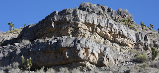
Meiklejohn peak is an middle Ordovician (Whiterockian) lime mud-mound which grew on the edge of a large carbonate ramp that was itself fairly distal (~10-100’s of km) to the Ord. coastline. The picture below shows the mud-mound in outcrop; that’s all depositional topography, by the way. The mound has several jumbled up and cemented breccias and slump-block along its edge, and according to Krause (2001) may have had a depositional slope of up to 55°!


Underlying the mound is the Ord. (Ibexian) Nine Mile shale, which had some rare trilobite bits and some bioturbation. The mound is overlain by the Antelope Valley Limestone, which is supposed to be fairly fossiliferous. Interestingly, the mound itself looks fairly abiotic, with no clear evidence for reef-builders or bafflers. What is present, however, is considerable evidence for very early cementation, in the form of “zebra-rock”, shown below.


This stuff is pretty crazy stuff, and apparently is a fairly poorly-understood rock. The white-bands are early cements that apparently grew in situ within the carbonate mud; you can see how some of the bands merge and bifurcate, maybe suggesting that they have an anastomosing network geometry in three-dimensions. Apparently, some workers have used these to infer the presence of clathrates near the mound, which would provide a mechanism for early carbonate precipitation within the sediments.

A brief jaunt into the adjacent and overlying Antelope Valley Ls provided a respite for the more paleo-oriented in the group, in the form of some gastropods (pictured below, from another fellow field-tripper).

In the afternoon, we slipped into Death Valley via the road from Beatty, which cuts through some nicely exposed alluvial fan and reworked fan conglomerates, and stopped by what must be THE MOST PHOTOGRAPHED SAND DUNES IN THE WORLD. Seriously, tourists seems to really like the ol’ sand dunes.

The sand was actually really interesting, petrologically; in addition to rounded fine-grained quartz, there were also lots of sand-sized basalt grains and volcanic glass, which were getting concentrated on little deflation surfaces along ripple crests. Additionally, there were some pretty nice mud-cracked, fine-grained, interdune deposits. Even for someone notoriously inept at picture-takin' (like me), it was fairly photogenic:


There were some nice exposures of cross-stratification under some of these surfaces, as shown below:


Tomorrow, I’ll show you guys some absolutely awesome debris flow stuff, so stay tuned!
Sunday, March 30, 2008

Death Valley Day 0.5 - Devonian Spring Mountain Carbonates

For about ten days, eight grad students (myself one of them) and two profs bopped around Death Valley, taking in the absolutely phenomenal geology of the place. Honestly, Death Valley is sort of a mecca for geologists. It pretty much has everything you could want: Proterozoic-Cambrian transition, the Sauk and Tippecanoe super-sequences, miogeoclinal carbonates (plus a few lonely siliciclastics here and there), extensional tectonics (turtlebacks and offset fans!), some of the slickest alluvial fans anywhere (both in section and on the surface), and evaporative playas. This should come as no surprise because, as my grandmother used to say, “For good geology, gimme the basin-and-range any day of the week!” (not really).

Anyway, we flew into the festering pit of decadence and hubris that is Las Vegas, and immediately made our way for the Spring Mountains, where we set up camp just below the snow line. Come dawn, we found that we’d pitched our tents next to some pretty neat outcrops, so our first stop was an hour of poking around some pretty nifty carbonate parasequences, shown in the picture below.


This picture was actually taken by a friend of mine, with a camera that I understand cost approximately $6,000,000,000, and therefore, takes very large and very good pictures. Anyway, you can see two “cycles” capped by thick, dark grey limestones. The lower portion of a cycle is made up of thinnly bedded carbonate with some disseminated sponge spicules and rare floating quartz grains, whereas the upper capping unit is made up of thick carbonate mud and silicified stromatoporoids, which were a spongey sort of reef builder in the Devonian. They’re shown in the picture below, again courtesy of my friend with the golden camera (I was selfishly saving my limited memory card for some alluvial fan stuff).


At the VERY top of the “cycle” picture above, we found a calci-clastic unit that exhibited some pretty nice (you know, for limestone) hummocky- and swaley-cross stratification. I think the picture below was mine, actually.


So the cycles seemed to be showing a lower, thinnly bedded limestone that was separated from overlying reef deposits by a sharp surface, which was itself sharply overlain by storm influenced reworked carbonates. Maybe this represents a shallowing upwards carbonate parasequence? Alternatively, I guess it could also maybe show a back-reef, reef, fore-reef trend? This is why I like siliciclastics; they do what the hydrodyanamics tells them to do.

Anyway, I think I’ve used up my allotted digital volume of images as dictated by Blogger, so I’ll have to post the rest of Day One later.

Wednesday, March 26, 2008

Oceans on Titan

Just a quick post to get my “blogging legs” back after a hiatus spent in Death Valley. There was a pretty slick article in Science recently (Lorenz et al, 2008: Science v. 319, 21 March 2008, p. 1649-1651) that claims to have found evidence for an ocean of water beneath the surface of Titan.

The workers were analyzing surface features on Titan, and noticed that they had drifted from a fixed point, which they explained as a result of increased rotation of the moon. The mechanism they evoke to explain this relies on the powerful winds in Titan’s atmosphere, which applies such a large torque on the surface, that it changes the rotation pattern. According to the models, this would only work if there was an ocean of liquid water under the surface.

Thursday, March 13, 2008

Death Valley Fans

I’m heading out to Death Valley over spring break, so I thought I’d post this neat LANDSAT image (from http://landsat.gsfc.nasa.gov/images/archive/f0007.html). Looking forward to seeing some Pre-C and Paleozoic miogeoclinal strata, seeing some extensional tectonics and turtlebacks, and looking at some ALLUVIAL FANS (a particular favorite or mine).

The alluvial fan controversy is actually a pretty fun topic, you know. It has certainly got some personalities in it, and they have made for some fun literature. A classic in the alluvial fan literature is, of course, Blair and McPherson 1994 (in JSR), which first identified the debris-flow dominated versus sheetflood dominated depositional model. This is a pretty marked departure from the humid-fan/arid-fan or braid fan models, and really changes what we can get out of older alluvial fan deposits.

The LANDSAT image shows two distinct fan morphologies. The smaller, distinctly conical fans emanating from the Black Mountains are sourced from small drainages that have formed in crystalline basement, metamorphic and intrustive suites, and some volcanic intervals. Below is a NASA worldwind image looking obliquely to the east at these fans and their drainages.

The western fans are larger, more lobate features sourced from the Panamint Range. These have larger drainages, and are sourcing Precambrian and Paleozoic sedimentary rocks. The NASA worldwind picture below shows an oblique view looking west towards these fans.

Anyway, I hope to have some good pictures when I get back!

Tuesday, March 4, 2008

Mars and Water

Tip o’ the Space Helmet to Geotripper for his Monday post (go and read it at http://geotripper.blogspot.com/2008/03/speaking-of-landslides-caught-on-film.html), which brought to light (for me, at least) a completely phenomenal picture of a landslide CAUGHT ON TAPE from Mars. It’s a little brain-boggling to think that some humans built a machine, lobbed it into orbit around Mars, and now that machine is sending us pictures back of another planet. Just goes to show that when Humans aren’t busy devising new and clever ways to kill one other, we can actually do some pretty nifty things.


Jumpin’ Cats! This picture is from orbit AROUND MARS! (pic from http://hirise.lpl.arizona.edu/PSP_007338_2640).

Anyway, the landslide pictures are pretty spectacular, and look for all the world like a dry, noncohesive granular flow. These images got me thinking about all the talk about water-driven geomorphic (or would that be areomorphic?) processes inferred from Martian pictures. Malin et al. (2000) and Malin et al. (2006) interpreted some gully-features on Mars as having been formed by water flowing on the surface of Mars, perhaps even as recently as 1999 (based on a the bright spots in some of the gulley images). Of course, the problem with water flowing on Mars is that the pressure/temp regime on the surface is such that most water would sublimate straight from ice to vapor.

Kraal et al. (2008) present a combined image-interpretation and sand-box actualistic experiments to suggest that certain features on Mars represent rapid water release (from a subterranean source), thereby getting around the sublimation problem.


Figure 1 from Kraal et al. (2008), pg. 973, showing the interpreted topographic feature. The authors make use of a confusing sort of terminology, seemingly equating deltas and alluvial fans (contra McPherson et al. 1987). Regardless, Kraal et al. (2008) interpret the sediment volume of the feature, and conclude that flows equal to the discharge (instantaneous? Annual? It isn’t ever clearly stated) of the Mississippi River could have produced this step-like feature in the course of a decade. They evoke a sudden release of underground water to account for this high magnitude, but short duration, flood event.

However, a recent paper from Pelletier et al. (2008) calls into question the fluvial origin of the Martian gullies. Pelletier et al. (2008) construct a DEM for an active Martian gully feature (complete with bright spots!), and use it to constrain 1-D and 2-D numerical flow models meant to constrain what flow types could account for the features. They show that liquid flows can produce the needed run-out length for the feature, but can’t produce the distal distributary lobe (of course, one may reasonably ask whether or not the distal distributary lobe is the result of a single event OR if it represents multiple events superimposed on one another; that option is not explored in the paper). However, dry debris flows can be modeled successfully that mimic both the needed run-out length as well as the distal lobate features. Pelletier et al. (2008) also state that wet debris flows could produce the same features as dry debris flows. Despite this, there is no need to evoke water to explain the features.

Looking at these newest pictures showing a large scale avalanche type feature on Mars, it just goes to show that interpreting geomorphic and sedimentary processes is difficult, no matter where you go in the universe!

REFS

Kraal, E.R., Van Dijk, M., Postma, G., Kleinhans, M.G., 2008, Martian stepped-delta formation by rapid water release: Nature, v. 451, p. 973-976.

Malin, M.C., and Edgett, K.S., 2000, Evidence for recent groundwater seepage and surface runoff on Mars: Science, v. 288, p. 2330–2335, doi: 10.1126/science.288.5475.2330.

Malin, M.C., Edgett, K.S., Posiolova, L.V., McCauley, S.M., and Noe Dobrea, E.Z., 2006, Present-day impact cratering rate and contemporary gully activity on Mars: Science, v. 314, p. 1573–1577, doi: 10.1126/science.1135156.

McPherson, J.G., Shanmugam, G., Moiola, R.J., 1987, Fan-deltas and braid deltas: Varieties of coarse-grained deltas: GSA Bulletin, v. 99, p. 331-340.

Pelletier, J.D., Kolb, K.J., McEwan, A.S., and Kirk, R.L., 2008, Recent bright gully deposits on Mars: wet or dry flows?: Geology, v. 36, p. 211-214.

Sunday, March 2, 2008

Trace Fossils and Hydrocarbons

The utility of trace fossils in exploration geology is fairly obvious, such as constraining depositional environments or identifying chronostratigraphically important surfaces. Their impact on the production side of things, however, tends to be viewed as a purely negative effect; the critters are churning up all the lovely sandbeds, bringing mud into the system, and generally screwing-up all the nicely sorted sands. A relatively recent paper (Pemberton and Gingras 2005) shows how this assumption may be incorrect.

The authors point out that the view of bioturbation as a simple sediment-churning activity is a gross oversimplification. The nature of the activity defines what the trace morphology and characteristics will be. For instance, some critters may excavate extensive dwelling burrows, penetrating meters into the sediment; depending on the density and interconnectedness of the animals and their burrows, some of these dwelling structures may be quite extensive.

As an example, the authors point to the Jurassic Arab-D, Ghawar Field, Saudi Arabia, which is the largest oil field on earth, with estimated reserves of 75 and 83 billion bbl. The reservoir interval had been interpreted previously as being dominated by fracture porosity. In this paper, however, Pemberton and Gingras (2005) reinterpret the unit as an expression of the Glossifungites ichnofacies, developed on a regional ravinement surface. The traces were made in a micritic substrate, and have a sucrosic dolomite infill (interpreted to be detrital in origin). The differences in porosity and permeability between these two contrasting lithologies is striking, resulting in what the authors term a “biogenic plumbing system”.


This paper has some very nice figures in it; I suggest you print it in color, if it’s available, just to take advantage of some of the nice core photos. It also has some artwork quality images, painted by T.D.A. Saunders. The figure above is Fig. 6 of Pemberton and Gingras (2005), found on page 1500, and shows the conceptual model for the development of the Ghawar field plumbing.

The paper goes on to identify five separate kinds of biogenically-enhanced permeability, and presents several case studies in producing reservoirs where these different processes seem to play an important role. These processes range across a variety of depositional environments and facies, and include both clastic and carbonate systems.

The impact that these burrow systems have on the reservoir potential of some of these units is staggering, as is the potential for vastly under- or over-estimating the potential reserves by not taking these networks into account. All in all, it’s a pretty nifty paper, and one I would strongly recommend for the petroleum-focused among us.

Pemberton, S.G., and Gingras, M.K., 2005, Classification and characterizations of biogenically
enhanced permeability: AAPG Bulletin, v. 89, n. 11, p. 1493-1517.