The insane Republican mantra of "DRILL EVERYWHERE!" has been one-up'd recently by everyone's favorite fugue-state maniac, Michelle Bachmann! Whereas the previous crop of knuckle-heads had merely ignored environmental or economic reasons for not tearing the Earth asunder, ol' Bachmann has gone the final step, and is completely ignoring REALITY in here fervent rush to drill the hell out of the US (for Jesus). Her latest scheme for Energy Independence? Drill the Everglades.
Now, most folks would hear about that plan, and decide that, EVEN if there was oil lurking below the peaty vastness of Everglades National Park, perhaps completely destroying one of the most delicate ecosystem in the continental US might not be such a good idea. Hell, the everglades are already stressed by horrendous water issues and terrible invasive organism problems; in the immortal words of the internet, "Leave the Everglades alone!"
But let's say you're some libertarian asshole that doesn't give a piss for the environment. Let's say you couldn't care less about a swath of incredibly beautiful, biologically rich, and ecologically amazing piece of real estate that represents a triumph of the egalitarian spirit of the National Parks System; is there any reason that we SHOULDN'T be drilling in the Everglades for the vast hydrocarbon reserves of southern Florida!?!
Well, one VERY good reason for NOT drilling in the Everglades is that, as it turns out, there ain't any goddamn oil or gas there. And, unless BP has recently initiated an ambitious peat-cutting scheme as a response to their deep water woes, I don't think there's much of a chance of anybody actually wanting to drill into the Everglades any time soon.
Albert Hine, a University of South Florida Geologist, pointed this out to some reporters, who took Hine's observation to Bachmann for comment. Bachmann's response? "The radical environmentalists put up one road block after another to prevent accessing American energy". Intense, huh? AND, despite the fact that she was completely ignorant and wrong about the everglades AND has had it pointed out to her, Bachmann is STILL endorsing a plan to open-up south Florida to oil and gas exploration. That level of madness, pure and blinding as a the sun, is the sort of can-do attitude that the Tea Party brings to America! Facts? Fuck em! We don't need no stinkin' liberal-commie facts!
Wednesday, August 31, 2011
Sunday, August 28, 2011
Sed Structure Sunday - Real Rivers!
As a continuing service provided by this blog, we'll be using this edition of Sed Structure Sunday to illustrate some of the characteristic features of that strange and mysterious geomorphological entity known as a "RIVER", which apparently has befuddled some folks. Here's a picture of the Green River, Wyoming, showing that most characteristic of river attributes, THE SUBAERIAL CHANNEL, i.e., the big ass declivity through which the water flows.

Note the difference between this sort of water/sediment transport system, and say, tiny adhesive droplets of water flowing at low Reynold's numbers through interstitial pore-space. Pretty much not at all the same thing. Pretty goddamn different beasts all together, when you get right down to it.
Here's a picture of a little bank-attached barform, accreting laterally into the channel. You can also see, to the left of the little point bar, a spot where lower flows cut into the toe of the bar, leaving behind a coarse-grained lag (predominately made up of oil shale weathered off the slopes).

Here's some rad current-ripples on the barform surface, showing flow to the right of the picture (hammer for scale).

And here's a close-up of the same. Neat, huh! Note the muddy drapes present, left behind during the very end of the falling stage of last flow to come through here. Thus are mud rip-ups born!

Friday, August 26, 2011
Backup Amazon (in case the other one breaks?)
That bastion of careful, insightful science journalism that is The Internet is abuzz with stories of a "second Amazon river" discovered some 4,000 m (!!!) below the Original Recipe Amazon at the surface. The work was done under the auspices of the National Observatory of Brazil, which actually provides a pdf version (in English!) of Pimental and Hamza's talk here. You can find all sorts of third-party stories on a number of "news" websites, apparently because "underground river" is just the kind of evocative bullshit that gets noticed by what passes for science journalists these days. I won't link to them, because they're uniformly stupid.
To summarize their work, Pimental and Hamza report on geothermal data from 241 wells (apparently drilled by Petrobras); 185 of the wells are located in "sedimentary basins", while the remaining wells are located "outside" of those regions, presumably piercing non-sedimentary materials, although that's an assumption I'm making, not one reported in the pdf version of the talk linked above.
The wells monitored what was assumed to be advective heat transfer, which is to say the transfer of heat through the migration of fluids; in this case, deep groundwater moving through permeable rock in the subsurface. Keep in mind, I'm no hydrologist, so I don't know much about the technique of geothermal monitoring and abstracting flow characteristics from that sort of data. There must be, of course, a whole slew of geological factors that influence flow in the subsurface, ranging from sedimentological and stratigraphic attributes all the way to structural geological considerations; however, those data may not be available for the Amazon Basin, or at least weren't reported in Pimental and Hamza (2011).
Importantly, Pimental and Hamza (2011) construct a bunch of 1-D models of heat flow for their individual well sites, and make the assumption that the observed geothermal curves are a result of advective heat transfer. These 1-D thermal profiles are then extrapolated across the basin. Then they divide up there wells into "upper" and "lower" populations (upper and lower in terms of depth), and interpret the different velocities for those different depths as indicating different flow patterns. As reported by Pimental and Hamza (2011), they interpret that there is a lateral west-to-east flow transfer present in the deeper aquifers.
So far, that all seems all right to me; sure, there are problems in extrapolating 1-D data to 3-D basins goes, and maybe there are problems with the assumptions that went into the methods, but that's all fine and good and offers avenues for further investigation. And, of course, the one bright spot in all the reporting has been the idea that these results are preliminary, and that future work will be done to interrogate them further.
The problem, as far as I can see it, comes in when Pimental and Hamza start to compare the surface flows of the Amazon River with their interpretations of subsurface flow, leading the authors to make some kinda big-deal claims about the importance of this groundwater system. They have a graph, on page 23 of the pdf version of their talk, that provides this comparison. I'll wait while you take a look.
I have some problems with their numbers. First of all, I don't exactly understand what the hell they mean when they say "surface drainage". It seems like they are talking about the channelized system alone, since they label one column "Amazon River" but the width value they give is kind of off...the Amazon, at low flows, ranges from 1 to 10 km wide, but when experiencing above bankfull conditions it'll spread out to 50 km or so. Are Pimental and Hamza just sort of averaging the width to somewhere between 1-100 km? Or are they also talking about overland flow in the floodplain drainage? Who knows?
By far, though, the goofiest number is the discharge value given for the Amazon. Look, the paraphrase Douglas Adams, the Amazon River is big. Really big. You just won't believe how vastly, hugely, mindbogglingly big it is. It supplies like 20% of the freshwater to the ocean, for god's sake! But Pimental and Hamza provide a MUCH too small estimate of the Amazon's annual discharge. They state that the flow rate is 133.000 m^3/s, which is either 133 or 133,000 with that weird euro-convention of a period instead of a comma. I'll give them the benefit of the doubt and assume that they don't mean 133, which is silly, but even 133,000 is only half of the actual number. Estimates for discharge range a little closer to 210,000 m^3/s, with an upper value of +300,000 m^3/s during the rainy season. This, in comparison to their groundwater flow estimate of 3900 m^3/s. Orders of magnitude, folks. AND that's assuming that the discharge value for the groundwater stands up to further interrogation.
If you look at the number, however, the overall contribution of the groundwater value reported is ~1-2% of the discharge of the huge ass Amazon River. Yet, for some reason, the National Observatory of Brazil put out a statement that says that this is the "likely" that the low salinity found at the mouth of the Amazon is caused by this groundwater contribution. That is a stupid thing to say, National Observatory of Brazil. The reason the ocean is fresher at the mouth of the Amazon is because the Amazon is a fucking HOSE, dumping an unbelievable amount of freshwater into the sea at an ungodly rate!
Most annoyingly, of course, is the fact that for some inexplicable reason, Pimental and Hamza (2011) refer to this subsurface flow as a "River", even going so far to name it the "Rio Hamza" in honor of one of the authors. And, of course, it's the "underground river" angle that got the newsoids all excited. I honestly can't tell why Pimental and Hamza decided to do that; is it just poetical, or what? Look, people are already stupid enough, and think that the water they get out of a well taps into underground rivers in caves, or huge open water lakes deep in the earth, rather than recognizing the truth about interstitial water between grains. For the love of god, don't confuse them any further by making them think that, 4000 meters below the Amazon River there's a second river, flowing along and full of subterranean Caimans, BECAUSE THAT'S WHAT PEOPLE THINK WHEN THEY HEAR UNDERGROUND RIVER!
To sum up my view on the whole thing: Pimental and Hamza (2011) identify some tantalizing evidence that there might be some lateral mobility in the groundwater deep in the Amazon Basin, and that this water might discharge into the open ocean at the mouth of the river. This was based on a bunch of 1-D well log models of flow velocities extrapolated over the whole area of the basin, and not on any sort of tracer study or more complicated modelling. The amount of water discharged is inferred to be ~1% the value of the Amazon River's discharge, which is nothing to sneeze at, but this is going to need a LOT more data to validate such a conclusion. For some reason, the authors decide to name tiny little blebs of water squishing along through interstitial pores a "River", which is wrong and terribly confusing to people who are already shockingly ignorant about how the earth works.
The whole thing makes me mad, but now when you search "Amazon River" on the Googles, you're going to be faced with a bullshit story about a "second River", without any attempt by any of the "journalists" to point out that, well, you know, water might be moving underground and all, but it sure as shit ain't a river, and it certainly ain't on the goddamn scale of the, you know, ACTUAL RIVER sittin' up there on the surface. My prediction: you will never hear about this work again, because future work is going to DRASTICALLY reduce the actual discharge estimates from the groundwater.
Ugh.
Tuesday, August 23, 2011
Apocoloquake? Earth Quakemaggedon? Quakes on a Plain?
Man, how rad is the USGS? I'm always impressed with how quickly they move when it comes to getting the info out there for earthquakes, and they certainly didn't let us down with regards to the VA earthquake! Anyway, just to head off the inevitable nutjob rapture-ready end-o-the-world types, I thought I'd post the USGS's 2008 Earthquake hazard map. See, VA has a higher hazard rating than most of the east coast! Nothin' supernatural or eschatological about it. Who knew!?! (Answer: the USGS).
 Equally rad is the chance for some good ol' fashioned citizen science at the "Did You Feel It" site, where you can help the USGS build a picture of the effects of earthquakes by adding your own report. Do so NOW, before future Co-Presidents for Life Bachmann and Perry shut down the communistic hive of nanny-state socialism that is government funded science!

Sunday, August 21, 2011
Sole-Saving Sed Structure Sunday!
Brian shared an image of some completely rad flute marks on Friday, which has inspired me to dedicate this Sunday Sed Structure to saving some SOLES! Sole marks, that is! As Brian pointed out, sole marks are a whole suite of erosional features generally preserved on the lower boundaries of beds. Sole mark taxonomy can get complicated, because the features are caused by a range of subtle processes that grade into each other; however, you can safely subdivide sole marks into those produced by fluid scour versus those produced by tools or objects interacting with the substrate. Below is a quicky flowchart I made for a sed class I TA'd in the past, describing some of the salient features of the different "kinds" of sole marks.

Sole marks are pretty cool; they're some fairly solid paleocurrent indicators, even when they only give you a trend of motion without a sense of direction. More important than that, however, is the fact that, at least for the scours like flutes marks and gutter casts, these sole marks actually represent pretty dramatically high energy conditions, much higher than for any measly ol' cross-stratification your going to find. That ability to start subdividing energy states in a stratigraphic section is key, and sole marks are incredibly useful when interrogating strata at fine scales of resolution.
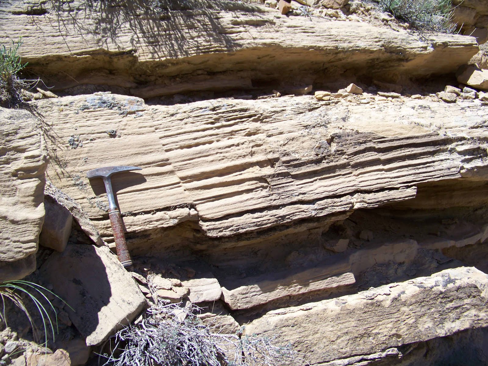
Anyway, the picture below is from some Wilkins Peak Ss (Eocene, Green River Formation), showing a sole mark on the base of a channelform. This is an example of a groove cast, meaning that a big ol' chunk of something (probably some wood) scrapped along the base of this channel. At some point later, river sediments filled in the erosion gouge, casting the feature we see below. Importantly, these features that record erosion, exposure, and high energy are often found in association with things like lag deposits.

This picture below shows some smaller groove casts in a parallel grouping, from the same succession of rocks.

Show some love for some erosional features, and they'll love you back, I promise.

Sole marks are pretty cool; they're some fairly solid paleocurrent indicators, even when they only give you a trend of motion without a sense of direction. More important than that, however, is the fact that, at least for the scours like flutes marks and gutter casts, these sole marks actually represent pretty dramatically high energy conditions, much higher than for any measly ol' cross-stratification your going to find. That ability to start subdividing energy states in a stratigraphic section is key, and sole marks are incredibly useful when interrogating strata at fine scales of resolution.
Anyway, the picture below is from some Wilkins Peak Ss (Eocene, Green River Formation), showing a sole mark on the base of a channelform. This is an example of a groove cast, meaning that a big ol' chunk of something (probably some wood) scrapped along the base of this channel. At some point later, river sediments filled in the erosion gouge, casting the feature we see below. Importantly, these features that record erosion, exposure, and high energy are often found in association with things like lag deposits.

This picture below shows some smaller groove casts in a parallel grouping, from the same succession of rocks.

Show some love for some erosional features, and they'll love you back, I promise.
Saturday, August 20, 2011
"Cognitive Sewage", Public Policy, and Communicating Science
A perennial lament heard on the science-scene: "why is The Public so damn irrational!". The frustration of having perfectly sound science ignored or rejected out of hand by Folks must account for more than a few gray hairs (although it's probably good for beer sales). We're all pretty familiar with irrationality born of wacko-idealogies, like creationists, climate change deniers, or expanding earthers; from the stand point of Science, there's not really much you can do about those deeply rooted irrationalities that motive people like that.
The earth sciences (broadly defined) have a lot of interaction with the irrational public, largely because we deal with complex systems that have a definite effect of peoples' lives. It's hard to get worked up about quarks (beyond the "gee-whiz" factor, I suppose), whereas acid mine drainage, or peak oil, or ocean acidification have a very concrete ability to impact people and the environment. How do we engage people about these complex issues?
There's a really interesting story up from NPR, which previously aired on Morning Edition a week or so ago, titled "Why Cleaned Wastewater Stay Dirty In Our Minds". Briefly, some clever engineers down in California have been looking for solutions to the region's horrible water situation, and they came to a very reasonable, rational, and environmentally sound conclusion: recycle sewage water into potable drinking water for communities. Pretty good idea, huh?
BUT, when they tried to implement the plan, the public balked. Rather than gnashing his teeth, a UC-Santa Cruz Environmental Studies prof decided to tackle the question of WHY people reacted so negatively to such an eminently reasonable idea. And the way he attacked the problem was through psychology. What they found when they talked to people was that people was that, as in a lot of human experience, people were engaging in what is called "contagion thinking". A pretty clear example of this is given by a psychologist who participated in the study: if asked to value a family heirloom versus an EXACT replica of the heirloom, people pick the original, since it has a history (through contact) that makes it MORE valuable, even if two objects are identical physically.
This sort of thinking carries over into how people think about resources; if their water has ever been in contact with sewage, it's contaminated irrevocably, which gives rise to the completely rad phrase used in the study of "conceptual sewage". Even more interesting was what the study found in regards to people's view on preferred water resources. Given the choice, people would rather have water from a river or aquifer than from treated sewage, despite the fact that water in rivers or aquifers has, through a matter of course, at some point been in contact with something's digestive/excretory system. Unless we start synthesizing water directly from volcanic gases, or from the atomic furnaces of stars, you aren't going to be free of the historical fact that, at some point, someone or something pissed in your water supply. So why doesn't that bother people?
The question sort of get's at peoples' conceptualization of what is "natural" or "clean", and seems to hinge on the idea that, through the natural processes that feed rivers or supply aquifers, some sort of conceptual transformation in applied to the water that makes it "clean". In the article, it's suggested that, by introducing some sort of "naturalizing" aspect to the sewage treatment might make it more palatable (both figuratively and literally) for people. This despite the fact that, as noted in the story, pumping treated water back out into the environment is, objectively, going to degrade it's quality.
It's a really interesting article, and one that we as Earth Scientists should really be paying attention to. What we do and how our science is used impacts peoples lives, and we need to be aware that is in and of itself a transformative process. Science as an adviser to policy has to take into account the history, psychology, sociology, and cultural milieu that it's trying to influence, and that's something that we science-types just don't seem to think about all that often. Take the water issue discussed in the NPR story. One approach could have been to have just said, "too bad, we need to conserve water so we're going to recycle sewage". What response might that engender in the public? Maybe they start buying only bottled water, exacerbating water supply issues and producing mountains of plastic garbage. And poorer people might not be able to afford exclusivity bottled water, exacerbating class division and economic disparities. OR poorer people might decide that, since the water from the faucet is (cognitive) shit, they're just going to have to spend more of their money on only buying bottled water, stretching their fragile finances even further.
It's a complicated issue, and one that we really aught to be thinking about every day, and in a variety of situations. And the earth sciences are right at the heart of all these complex intersections between natural systems, people, society, economics...all that stuff that makes up the complicated mess we call the real world. The NPR report does a pretty good job introducing the topic, and the link above let's to listen to the audio version of the report that played on Morning Edition. Enjoy!
Thursday, August 18, 2011
Nifty phytoplankton bloom image
An awesome image of a huge plankton bloom in the Barents Sea, courtesy of the MODIS from the Aqua Satellite, taken on Aug 14. The Barents is at its freshest and most nutrient depleted during this time, due to glacial melt, which creates ideal conditions for a big ol' bloom of these tiny little organisms. Apparently, the milky blue colors are inferred to be the result of a bunch of coccolithophores, tiny photosynthetic bugs that make a produce calcite tests. Just think; if you were in orbit during the Cretaceous over the eastern end of the Western Interior Seaway (say, Kansas or Nebraska), you might have seen just such an scene! And check out those Helmholtz whirls where the plume is mixing with the ambient water! Rad!

The image, and more information about it, can be found at NASA's Earth Observatory page.

The image, and more information about it, can be found at NASA's Earth Observatory page.
Wednesday, August 17, 2011
In Hell: Two Years with Tea Party
Have you heard about these "Tea Partiers"? You might have missed them...they're a pretty quiet lot that prefers to lay low and let their carefully reasoned and well-crafted arguments do their talking for them. When I think of Tea Partiers, I tend to envision some frothy Randian with a tenuous grasp on economics, but this article suggests that the tax/libertarianism aspect of the group is largely flash-in-the-pan opportunism. The real core value of these people, as we all probably already know, is a rabid Christian fundamentalism that promulgates a revisionist version of US history as a means of legitimizing their batshit insanity. I for one am shocked! SHOCKED!
The Embiggening Earth Redux
A few years back, at the Dawn of this Blog, I posted a little piece about the ridiculously pseudoscientific idea of the "Expanding Earth". Apparently there are crazy people with no understanding of science or rationality who think, for a variety of insane reasons, that Plate Tectonics is yet another example of a Big Science Conspiracy that seeks to bury the truth: namely, that the Earth is getting bigger through time, and that everything we know about geology, chemistry, physics, biology, etc, is all a BIG LIE!!!!!!!! It's pretty weird stuff, and some of the comments on the above linked post were so nutty that folks with peanut allergies shouldn't read them.
Anyway, to the vast corpus of evidence in support of plate tectonics (i.e., predictability/explicative power of sedimentary basins, mountain belts, and a whole lot of tectonic features, apparent polar wander, geophysically observed subducted crust, sea-floor spreading, etc, etc, etc) we can NOW add a DIRECT MEASURE of the changes in the Earth's radius. The rate of change, according to this JPL/NASA study, is ~0.1 mm/year, which is within instrument error and not statistically significant. In other words...the Earth ain't embiggening.
It's a pretty nifty example of detailed geodetic measurements, gravity measurements, and complex data processing that provides a pretty robust direct measure of everything we already knew about the Earth. The paper, which goes into all the nitty-gritty goodness of complicated geo-math, was published in Geophysical Research Letters, and can be found here.
Of course, as we all know, their ain't no gettin' through to the True Believers, and they will no doubt see this as more evidence for the vast science conspiracy that seeks to thwart their brilliance and hid the importance of their unified field theories of everything. Oh well.
Friday, August 12, 2011
Boar's Tusk!
Following up on yesterday's post and Callan's rad red desert gigapan, I thought I'd share a couple more shots, this time of the Boar's Tusk and a little of the Killpecker dune field. If you ever find yourself along Highway 191, you'll be driving right alongside a pretty phenomenal little bit of the high desert that, in addition to some slick geology, is also full of nice scenery. I'd just caution, however, that if you DO decide to drive on the BLM roads, make sure you've got a vehicle with good clearance and four-wheel drive...it can get a little dicey!
Anyway, a prominent feature in the area is the Boar's Tusk. Just like the more famous Devil's Tower, this pinnacle is a Pleistocene-aged volcanic neck that marks the formerly active volcanic fields of the area. It's about 400 feet tall, and is a favorite nest-building site for hawks in the area.

There's a steep little path up to the saddle, but like all volcanic terrain, a fall here can really hurt, so do be careful.

Here's a view, from the saddle, looking south towards White Mountain (the low plateau to the right).

And here's a view looking north, into Killpecker dunes, which is one of the largest active dune fields in the region. Although it's pretty from a distance, the dunes are infested with 4-wheelers and ATVs and the associated jackassery that goes along with it.

Nothin' TOO spectacular, rock wise, but there's some all-right volcanic stuff to look at, IF that's your thing...

The Boar's Tusk has also lent it's name to a beer available at the Bittercreek Brewpub in Rock Springs, WY.

Thursday, August 11, 2011
White Mountain Petroglyphs
Callan recently put up a pretty slick gigapan of some rocks near and dear to my heart. He's got an awesome shot of the Green River Formation exposed on the flank of White Mountain, which I've talked about before (I work in the fluvial portions of the Wilkins Peak Member of the ol' Green River Fm, which is the most clastic phase of the Green River).
If you ever find yourself in the area, you could do worse than just heading north up Highway 191, and taking some time to explore the BLM roads in the area. There are actually some pretty cool petroglyphs to be found in the fluvial sandstones of the Wasatch Formation (Paleocene/earliest Eocene) that underlies the Green River Fm in the Bridger Sub-basin. I visited a BLM-run spot on the flank of White Mountain that showcases some of the best ones to be found in the area, and I thought I'd share some photos:


The picture below is a little washed out...but if you embiggen it by clicking, you'll see an elk:


Pretty neat! The Sweetwater County tourism board has some info available on the BLM administered site, including driving directions, here.
If you ever find yourself in the area, you could do worse than just heading north up Highway 191, and taking some time to explore the BLM roads in the area. There are actually some pretty cool petroglyphs to be found in the fluvial sandstones of the Wasatch Formation (Paleocene/earliest Eocene) that underlies the Green River Fm in the Bridger Sub-basin. I visited a BLM-run spot on the flank of White Mountain that showcases some of the best ones to be found in the area, and I thought I'd share some photos:

The picture below is a close-up of the buffalo(?) in the above shot:

The picture below is a little washed out...but if you embiggen it by clicking, you'll see an elk:


Wednesday, August 10, 2011


Tuesday, August 9, 2011
Wave Ripple Formsets
The tragedy of ripplemarks; ridiculously common, and by and large completely useless when it comes to halfway decent paleocurrent measures. They're just too damn variable, and too easily influenced by extremely local current conditions to be reliable. Oh well...at least they're pretty!


Sunday, August 7, 2011
Brittle synsedimentary deformation!
Synsedimentary deformation is pretty common; pretty much anywhere you go in the stratigraphic record, regardless of age, sediment type, or environment, there will almost always be some sort of sedimentological chaos present. While structural deformation (i.e., deformation due to tectonic processes after burial) is cool and all, synsedimentary deformation (where the chaos occurs contemporaneously with deposition) is, on a purely objective level, much cooler; just think about a delta front slump, the collapse of a point bar, or the huge deformation related to a mass transport complex! And, while the deformation is itself kinda cool to envision, the potential stratigraphic effects that such local reorganizations can have are even more amazing!
Synsedimentary deformation, like all deformation, comes in two flavors - ductile (i.e., folding) or brittle (i.e., faulting). Ductile deformation is probably the most familar style of sysedimentary chaos-ification, and can range in scale from individual mm-scale laminae slipping and folding all the way to huge fold-and-thrust belts at the toes of submarine fans. However, I get the feeling that brittle deformation is maybe more common in the rock record than is often reported, especially at the smaller end of the scale.
The picture below is from the cretaceous Ferron Ss, at the famous and picturesque Muddy Creek, Utah, and shows some examples of synsedimentary faulting we're talking about. These are in deltaic sediments:

Here's another, from the same section! Nifty, huh?

One more from the Ferron, for good measure!

And, finally, here's syn-sedimentary deformation showing both the faulting AND some subtle "growth-strata" like compensation/adjustment in sedimentation as a result of the deformation, all in one! These are from fluvial strata in the Eocene Green River Formation.

The importance of these brittle processes can't be overestimated, since synsedimentary extensional faulting is an easy way to produce a whole lot of space in a short amount of time. This can produce some dramatic effects, since these little extensional grabbens are ideal sediment ponds. What's especially cool is that you can see synsedimentary deformation directly influencing sedimentation patterns in the rock record (in fact, that's how you distinguish it from the boring ol' structural variety of faulting). You can see how the angle of sedimentation changes as you move up; in otherwords, there's initially some steeply dipping sediments that fill the little pond, with subsequently shallower sedimentation as the wound "heals".
The picture below shows the fault chopping off some sediment below, and juxtaposing more massive sandstones in the hanging wall. Importantly, this deformation is localized, and overlying and underlying sediment don't show any additional deformation - that's how you know it's not related to structural/tectonic deformation, but in fact a process going on at the same time as deposition.

One more, showing the juxtaposition of more massive sands in the hanging wall right against the fault!

Finally, one last picture, showing the (sub-seismic!) outcrop scale deformation possible in some successions. Here, again from the Muddy Creek, are some of the weirdly angled "healing" sediments:

You can imagine how, from a resource perspective, these sorts of things could really complicate your reservoir, and you'd never even know about it!
If you're interested in reading a pretty nifty paper that goes into the palinspastic retrodeformation of these extensional synsedimentary systems in the Ferron, take a look at Bhattacharya and Davies (2004). It's a pretty fun paper that makes a neat study of the linked sedimentology, stratigraphy, and deformation going on in these rocks, AND it's available as a free pdf right here. It's a fun read!
WORKS CITED
Bhattacharya, J.P., and Davies, R.K., 2004, Sedimentology and structure of growth faults at the base of the Ferron Member along Muddy Creek, Utah, In: T.C. Chidsey, R.D. Adams, and T.H. Morris (eds.) The Fluvial-deltaic Ferron Sandstone: Regional-to-Wellbore-scale outcrop analog studies and applications to reservoir modeling, AAPG Studies in Geology 50. P. 279-304.
Synsedimentary deformation, like all deformation, comes in two flavors - ductile (i.e., folding) or brittle (i.e., faulting). Ductile deformation is probably the most familar style of sysedimentary chaos-ification, and can range in scale from individual mm-scale laminae slipping and folding all the way to huge fold-and-thrust belts at the toes of submarine fans. However, I get the feeling that brittle deformation is maybe more common in the rock record than is often reported, especially at the smaller end of the scale.
The picture below is from the cretaceous Ferron Ss, at the famous and picturesque Muddy Creek, Utah, and shows some examples of synsedimentary faulting we're talking about. These are in deltaic sediments:
Here's another, from the same section! Nifty, huh?

One more from the Ferron, for good measure!

And, finally, here's syn-sedimentary deformation showing both the faulting AND some subtle "growth-strata" like compensation/adjustment in sedimentation as a result of the deformation, all in one! These are from fluvial strata in the Eocene Green River Formation.

The importance of these brittle processes can't be overestimated, since synsedimentary extensional faulting is an easy way to produce a whole lot of space in a short amount of time. This can produce some dramatic effects, since these little extensional grabbens are ideal sediment ponds. What's especially cool is that you can see synsedimentary deformation directly influencing sedimentation patterns in the rock record (in fact, that's how you distinguish it from the boring ol' structural variety of faulting). You can see how the angle of sedimentation changes as you move up; in otherwords, there's initially some steeply dipping sediments that fill the little pond, with subsequently shallower sedimentation as the wound "heals".
The picture below shows the fault chopping off some sediment below, and juxtaposing more massive sandstones in the hanging wall. Importantly, this deformation is localized, and overlying and underlying sediment don't show any additional deformation - that's how you know it's not related to structural/tectonic deformation, but in fact a process going on at the same time as deposition.

One more, showing the juxtaposition of more massive sands in the hanging wall right against the fault!

Finally, one last picture, showing the (sub-seismic!) outcrop scale deformation possible in some successions. Here, again from the Muddy Creek, are some of the weirdly angled "healing" sediments:

You can imagine how, from a resource perspective, these sorts of things could really complicate your reservoir, and you'd never even know about it!
If you're interested in reading a pretty nifty paper that goes into the palinspastic retrodeformation of these extensional synsedimentary systems in the Ferron, take a look at Bhattacharya and Davies (2004). It's a pretty fun paper that makes a neat study of the linked sedimentology, stratigraphy, and deformation going on in these rocks, AND it's available as a free pdf right here. It's a fun read!
WORKS CITED
Bhattacharya, J.P., and Davies, R.K., 2004, Sedimentology and structure of growth faults at the base of the Ferron Member along Muddy Creek, Utah, In: T.C. Chidsey, R.D. Adams, and T.H. Morris (eds.) The Fluvial-deltaic Ferron Sandstone: Regional-to-Wellbore-scale outcrop analog studies and applications to reservoir modeling, AAPG Studies in Geology 50. P. 279-304.
Saturday, August 6, 2011
Teredolites, substrates, and stratigraphy
Trace fossils are pretty rad in and of themselves, but they become especially awesome when they start telling us all sorts of sedimentologically and stratigraphically interesting stories. Particularly nifty for us soft rock types is the fact that trace fossils quite often record all sorts of neat information about substrate conditions. In terms of paleoenvironmental indicators, subtle variations in the consistency and nature of underlying sediment can have important implications for reconstructing ancient ecology or paleogeomorphology.
Perhaps more importantly, a huge amount of stratigraphic information is often wrapped up in bioturbated surfaces. The most famous example is seen in the Ophiomorpha vs. Thalassanoides dichotomy, where the same critter (a shrimp) produces two very different traces depending on if the sediment was soft and mucky or firm and compacted. This distinction is important stratigraphically, as a compacted substrate reflects erosion and exposure of previously buried sediment. On the basis of trace fossil assemblages, stratigraphers and paleoichnologists have identified a continuum of substrate types, generally ranging from softgrounds (think gloppy mud, or loose, wet sand), firmgrounds, and hardgrounds (think exposed coral reefs). Substrate consistency has all sorts of implications for picking out chronostratigraphically important surfaces.
By far, the bulk of ichnology/seds work has been undertaken in the marine realm. However, heading up the profile into marginal marine and coastal sediments holds some pretty exciting trace-to-rock relationships for us to interrogate. Perhaps niftiest of the traces found in the somewhat-drier-world of coastal rivers is the humble Teredolites.
The wild Teredolites looks like a stubby bulb, with a broad base that tapers up towards a shallow opening. They're commonly sand-filled, though muddy ones are not unheard of, and they often occur in clumps along surfaces. These little club-shaped excavations are dug out by cute little bivalves, colloquially known as "ship-worms" today. The picture below, seized from the USGS, gives you an idea of what they look like:

Because I'm not an oil geologist, I don't own a yacht, so my exposure to these little fellows is limited only to the stratigraphic record. And perhaps somewhat surprisingly, these guys are actually pretty damn common! In fact, some horizons are pretty much taken over by Teredolites, indicative of a considerable amount of woody (or, to use the fancy science word, xylic) substrates. Bromley et al. (1984) recognized that this was a fundamentally different condition from the traditional soft-firm-hardground spectrum, and helpfully named these "woodgrounds". Furthermore, Bromley et al. (1984) characterize the Teredolites ichnofacies as a suite of traces that uniquely identifies the occurrences of woodgrounds in the rock record. Importantly, a Teredolites-bored log that happened to get washed out onto a submarine fan is NOT an example of the Teredolites ichnofacies; you need to have a lot of Teredolites, in association with a substantial and in situ woody substrate to qualify.
How is a woodground different from the other "grounds" and, perhaps more importantly, who the hell cares? Well, for one thing, the presence of woody substrates is pretty distinct environmentally as well as ecologically. Natural accumulations of woody material are unique types of environments, and take on a special meaning in the stratigraphic record, where they're known as "coal". In order to get coal in the stratigraphic record, you have to have minimal clastic input, otherwise you just end up with a pile of sand (for instance) with disseminated bits of plant debris scattered throughout. In other words, coal can be diluted to nothing by the addition of a bunch of sediment.
Teredolites is commonly associated with coal deposits in the rock record. The picture below is from the Cretaceous Mesa Verde of Utah, and shows some classic little teredos in association with coal underneath (bumpy bits in the sand, above the hammer; the coal is the black stuff). The trace, then, was bored into the woody stuff beneath, then infilled with sand from a high sinuosity coastal river. So, these traces record the existence of a major coal accumulating swamp...

...of coarse, the presence of all that COAL tells you that too, right? So what's the big deal?
Well, Teredolites is also sometimes found within sediments, often in channeform deposits of ancient rivers, without any associated thick accumulations of coal. Sometimes there will be little chunks of coaly/woody material associated with the teredo traces, and sometimes these clasts can be quite common in the bases of channels. But, there's no big prominent beds of coal to be found anywhere! The picture below, also from the K of Utah, shows just this relationship, with teredo traces and wood/coal fragments within fluvial sandstones.

These Teredo and wood debris intraclasts are actually telling us a pretty cool story. We know, from their presence, that at some point, deposits of woody debris accumulated in the ancient landscape, providing homes for a bunch of cute little shipworms. In otherwords, at some point, the paleoenvironment of the setting in the picture above must have been something like the everglades today; lots of plants, lots of life, and importantly, very little clastic sediment moving around the landscape.
BUT, since these Teredolites-bored wood chunks are clasts in a higher energy sedimentary deposit, we know that those idyllic evergladesean must have come to an end when there was a dramatic and fundamental reorganization in the "plumbing" of the sedimentary system. Where there had previously been slow, steady accumulations of plant matter and very little sediment, there eventually came to be a much higher energy system dominated by erosion and reworking.
This is a pretty amazing reversal, if you think about it. We go from a swamp to a coastal river system, and the only evidence for all the time it took to accumulate the coal is found in the wood-debris lag deposits in some ancient rivers. It's a pretty dramatic story of landscape evolution and sediment routing, one that is luckily pointed out to us by some helpful trace fossils and clasts. The stratigraphic record is dominated by these major shifts in sediment accumulation and reworking, and sometimes the only evidence for a completely vanished landscape can be found in some subtle and seemingly insignificant bits and pieces scattered throughout the preserved stratigraphy.
WORKS CITED
Bromley, R.G., Pemberton, S.G., and Rahmani, R.A., 1984, A Cretaceous woodground: the Teredolites ichnofacies: Journal of Paleontology, v. 58, p. 488-498
Friday, August 5, 2011
History of Oil podcasts
I recently came across another earth science-flavored podcast out there on the interwebs that folks might enjoy: A History of Oil. A strict adherent to truth in advertising, the podcast author/presenter is going through the history of everyone's favorite hydrocarbon in nice, digestible 10-15 minute segments. I've only listened to the first few episodes, but so far, so good! You can subscribe on that there iTunes! Enjoy!
This thing still on?
Whew! A little over a YEAR since the last post....kinda lame, but you know how it is. Busy busy busy, and all that wearisome nonsense. Anyway, maybe we can get this piece of shit blog back on the road, alright?
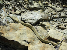
At the very least, let's give that poor Cnemidophorus tigris septentrionalis a little break, huh?
Here's a pretty picture of two rainbows, out Wyoming way, that may warm your hearts...

I promise the next post won't take a year to make an appearance!
At the very least, let's give that poor Cnemidophorus tigris septentrionalis a little break, huh?
Here's a pretty picture of two rainbows, out Wyoming way, that may warm your hearts...

I promise the next post won't take a year to make an appearance!
Subscribe to:
Posts (Atom)