Lost Geologist has the right idea: it's always time for Field Work! Although Looking For Detatchment and All of My Faults Are Stress Related make a good point, in that the weather can kind of suck this time year. That's why I'm escaping to Egypt for a little a while. To here, specifically:
Sun, sand, and exposure; what more could you wish for?
I'm heading out, Thursday evening, to the Valley of the Whales to do some marginal marine sed/strat work. I'll be back around Dec 7, hopefully with some rad pictures to share. Until then, enjoy winter (Suckers!)
Wednesday, November 19, 2008
Friday, November 14, 2008
I still think "Subduction Denialists" would be a great Band Name
Fun times in the constantly aggravating world of pseudoscience nutjobs! Brian, over at Clastic Detritus, has put up a very nice summary of the subduction vs anti-subduction worldviews, in THREE PARTS! Here's Part One, here's Part Two, and here's Part the Third.
Brian has a great summary up, though I think the real value of the work is seeing how absolutely crazy some people are. His Part One, a summary that provides the backstory of Brian's interactions with morons, nicely demonstrates the anti-intellectualism of the pseudo-scientist, marked by a rabid refusal to actually try and read up on the literature, and a general disdain for anyone who doesn't seem to share their gnostic world view.
A while back I put up a post on Neil Adam's Expanding Earth stuff; it's garnered a few comments, here and there, and has made for some fun reading (at least I think so). We've had a lot of memes floating around in the Serious of Tubes here; maybe we should do a Pseudoscience Meme?
Wednesday, November 12, 2008
Trace Fossils and the End Permian Extinction
The biggest extinction event in Earth History is the Permian/Triassic Extinction (~251 Mya), where almost 95% of marine species went extinct (that’s a lot!). In fact, it was such a serious extinction, that stromatolites made a dramatic resurgence in many shallow-water settings immediately following the big die-off. But, since it’s a Mass Extinction ™, folks are always wrangling over what the mechanism for the Big Kill-off was.
One of the popular explanations has been the oxygen-stress hypothesis, which posits that extensive anerobic and dyseroic conditions (perhaps related to unstable ocean water masses interacting with the unique paleogeography of the Permian world) may have played an important role in the extinction. A good summary of the End Permian Extinction mechanism can be found in Knoll et al. (2007), available here (for FREE!).
A recent paper in Geology, Beatty et al. (2008), points out that anoxic/dysoxic conditions present testable hypotheses, particularly in the paleontological realm. Permian body fossils, however, can’t really be used due to taphonomic complications; they’re just too chewed up. Beatty et al. (2008) instead use the trace fossil record from these intervals, and identify a complex suite of post-extinction ichnofossil assemblages preserved in high energy, shallow-marine deposits.
According Beatty et al (2008), these bioturbated shallow marine rocks represented oxygenated refugia in the otherwise anoxic Panthalassa Ocean. The figure below is Figure 3 from page 773 of Beatty et al (2008), and shows their explanation for why these oxygen rich shoreface successions existed:
In effect, wave agitation, enhanced by storm-activity, drove aeration in shoreface sands, while the deeper water settings suffered under anoxic conditions (which are borne out by the restricted trace fossils assemblages there). In these oxygen-rich shoreface zones, the effects of the oxygen-deficiency were greatly reduced, perhaps allowing for reduced recovery time following the end Permian event. It’s a pretty neat paper, and perhaps helps explain the occurrence of some Early Triassic ichnofaunas that didn’t seem to follow the apocalyptic pattern in other environments.
Man, is there anything those trace fossils can’t do!?!
References Cited
Knoll, A.H., Bambach, R.K., Payne, J.L., Pruss, S., Fischer, W.W., 2007, Paleophysiology and end-Permian mass extinctions: Earth and Planetary Science Letter, v. 256, p. 295-313.
Beatty, T.W., Zonnenveld, J-P, Henderson, C.M., 2008, Anomalously diverse Early Triassic ichnofossil assemblages in Northwest Pangea: A case for a shallow-marine habitable zone: Geology, v. 36, p. 771-774.
EDIT: Turns out Shanan Peters, of Mass Extinction Nature Paper fame, has commented on this paper in Nature's Journal Club; check it out here (if you have access to Nature).
Tuesday, November 11, 2008
Reptiles in the Field
Writing grants makes you envious of the simple life of wild animals; hanging out, chomping on whatever comes by, just straight-up going to the bathroom WHEREVER you want. Sigh, the good life...
Anyway, here are some cold-blooded bastards for you.
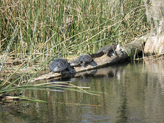
The picture below is from Wakulla Springs, down Florida way, and has turtles and an alligator demonstrating the proper manner in which one "hangs out".
This guy had places to go, and people to eat:
And this is a bearded lizard I found at 8000+ ft in Wyoming on a rainy day. Poor little guy needed a scarf or something.
Friday, November 7, 2008
Animals in the Field
Maybe professional industry geologists, like Brian, have gotten so soft sitting behind desks that they only associate with domestic mammals in the field. But here, in the grad school trenches, where life is hard and blood is cheap, we don't pansy around with animals that take orders from humans.
No sir, we roll WILD BURRO style, rocking the Death Valley with the O.G. of ungulates:
Awwwww...they're so cute! Who's a good burro? Who's a good burro then!?! You are a good burro!
No sir, we roll WILD BURRO style, rocking the Death Valley with the O.G. of ungulates:
Awwwww...they're so cute! Who's a good burro? Who's a good burro then!?! You are a good burro!
Some kind of special mustache
Here comes the secret Muslim/Marxist revolution! (If the video doesn't work, go here).
Better start growing those special mustaches right now, unless you want a Fatwa on your ass.
Thursday, November 6, 2008
One MORE Palin thing, and then it's back to geology, I PROMISE!
Oh man oh man oh man! Look at this! Look at this, from FOX NEWS:
So, to sum up, Sarah Palin:
1) thought Africa was a country
2) refused to prepare for the Couric interview
3) and threw "tantrums"
Finally, the pettiness inherent in the republicans is working FOR US! I can't wait...you know that for the next week or so, there is going to be a biblical-scale flood of hilarious anecdotes about Sarah Palin being a complete screw-up.
Oh man, when FOX NEWS is calling a Republican kinda dumb, you know that it is over. Seriously, I bet the Fox News people have all sorts of things posted for sale up on Craigslist; furniture at fire-sale prices, pallets of Ann Coulter books, jingoistic screaming heads for sale by the dozens. Stay tuned! Things are going to get hilarious!
Wednesday, November 5, 2008
Was it good for you guys too?
Man, what an acceptance speech! What a crowd! What an election! I know that we've still got a lot of work ahead of us, and that it's going to be a long, hard struggle, but I think it's important for all of us to sit back, and savor the fact that the republican nightmare of eight years has been utterly demolished, that the era of deregulation and rampant capitalism has come to a close, and that all those angry racist morons out there have been crushed.
Look at that poor dumb bastard up there!
Hahahahahaha! What a day!Tuesday, November 4, 2008
Election Night Scarlet Fever...Catch It!
Alright Cats and Kittens; we are rapidly approaching Zero Hour. I hope all my fellow secret muslim marxists out there are ready for their mandatory abortions at their respective gay-marriage/Obama victory party combo events.
Of course, Brian over at Clastic Detritus is quick to splash some cold water on our fervent optimism, and not without good reason. If there's one thing the Republicans have shown themselves adept at, it's the subversion of Democracy and the rule of Law to support their own fascist policies. That's why I took the time today to procure two things: celebratory beer AND a couple of gallons of good ol' fashioned riotin' gasoline.
Anyway, as we await The Results, here's some Sarah Palin hilarity for you guys. The gist of the little story is that Sarah Palin is very disappointed in the blogosphere, which has just treated her so unfairly, gosh-darnit!
And here is a handy dandy little accumulation of all of the ridiculous videos of Sarah Palin doing stupid things, including Getting Blessed By A Witch Hunter, the "I Read All Of Em" nonsense, and my personal favorite, the Bush Doctrine Explanation.
Man, I am not gonna miss her, let me tell you...
See ya'll Wednesday!
Vote, dammit!
Well, just got back from voting, and it warmed even the whithered cockles of my black heart to see SO MANY PEOPLE enjoying the sweet, juicy fruits of Representative Government. I mean, there were a LOT of people out, even at the 07:00 mark that officially began the ultimate defeat of the thoroughly disgraced neo-conservative, rightwing agenda!
Anyway, I'm sure many of you are going to be attending election night parties, where either we all will be celebrating the birth of a new government (an Obama win), or we'll be burning shit down (a McCain win). However, in the interests of keeping things interesting, below is a comic from Big Fat Whale, with a specific Election Night Game that everyone can play. Enjoy!
Sunday, November 2, 2008
Big, Blue Sky Country
Mwahahahahahaha! This pleases me!
I'll always have a soft spot for Montana, and though I'm not physically there now, I can still send good vibrations through the akashic ether to my fellow liberals in MT. We got John Tester into the Senate, and you Montanans can get Obama to the White House! Go Team Go!
Friday, October 31, 2008
At The Orogen of Madness
It seems that he pondered a great deal, and with alarmingly radical daring,
over that triangular striated marking in the slate; reading into it certain
contradictions in Nature and geological period which whetted his curiosity to
the utmost, and made him avid to sink more borings and blasting's in the
west-stretching formations to which the exhumed fragments belonged. He was
strangely convinced that the marking was the print of some bulky, unknown, and
radically unclassifiable organism of considerable advanced evolution,
notwithstanding that the rock which bore it was of so vastly ancient a date -
Cambrian if note actually pre-Cambrian-as to preclude the probable existence not
only of highly evolved life, but of any life at all above the unicellular or at
most trilobite stage. These fragments, with their odd marking, must have been
500 million to a thousand million years old.
H.P. Lovecraft, At The Mountains of Madness (1936)
Halloween is as good a time as any to reflect on the intersection between science (and, specifically, GEOLOGY) and Weird Fiction. One of my favorite Weird Authors has to be H.P. Lovecraft who, along with others like Robert E. Howard, Fritz Leiber, and Frank Belknap Long, transcended (sometimes) the simple medium of pulp horror and ushered in the modern age of science fiction. The quote above is from one of Lovecraft's most famous works, At The Mountains of Madness, and is one of my favorites for the very selfish reason that plot really hinges around geology. An online copy of the story is available here. It makes some good geo-Halloween reading!
First and foremost, the story is narrated by one Prof. Dyer, a professor of geology at the fictional Miskatonic University, in the fictional town of Arkham, Massachusetts, who is heading a scientific expedition to the Antarctic (set in the early 1910's); once there, they plan to take drill cores and sample the geology of the region. He's accompanied by other academics from the university, as well as graduate students. Already, it's a story near and dear to my heart.
Once in the frozen wastes of the Antarctica, the scientists' hopes of amazing discoveries are quickly realized; using the drill, they find many samples of fossils, including strange, ancient TRACE FOSSILS that no one can quite figure out. The quote at the head of this post is taken from the work, and is talking about these unusual triangular features. Interestingly, the geologist, Dyer, must be a sedimentologist, since he initially attributes the features to slightly metamorphosed "ripple effects". That's a good lesson, I think; always make the ichnologist convince YOU of the critter-origins for any weird marks.
Anyway, the biologist on the team apparently gets excited about these trace fossils, and as the quote above shows, draws some daring conclusions (spooooky conclusions, mind you) about what could have caused them. The search for the specific stratigraphic horizon on which these traces are found becomes the main focus of the expedition, who strike deeper and deeper into the unknown heart of Antarctica, and the increasingly more ancient mountains and strata that they discover.
Eventually, the biologist and some of the grads, who are pursuing the traces while Dyer and his students are doing other work (probably mapping...or drinking. They are geologists, after all), come across some "Comanchian" aged strata that host some cave deposits. Now, you and I probably have never heard of the Comanchian period, which was supposed to be between the Jurassic and Cretaceous periods, and was subsequently abandoned by the 1930's. However, since Lovecraft set the story in the Early 1900's, the geologists would still be using the term. Lovecraft, who was a very devoted lover of science, took special pains to make this story as scientifically valid (for its day) as he could, so it is actually an interesting historical document in that regard.
Anyway, within these caves, the biologists come across many fossils, of seemingly jumbled chronology, as well as huge, barrel-like "fossils" of an unknown, crinoid-like creatures, bigger than a human. They take these crinoid-creatures back to camp, where it turns out the Things may have some relation to the strange trace fossils found earlier. Oh, and they may not be quite so dead yet, either...
Lovecraft had a flair for the horrible and the weird, and took particular delight in how odd sea life was. A scholar of Lovecraft's life and work, S.T. Joshi, has made particular study of some of the influences on ol' Lovecraft (mostly using his 10,000+ letters that he wrote in his life), and has found that he had in mind for his crinoid-like Elder Things a particular Plate from the work of Ernst Haeckel. Below is the figure: Plate 90 from Haeckel's Kunstformen der Natur:
These crinoid Elder Things, with their alien physiognomy, also have another of Lovecraft's characteristic "horrible" attributes: incredible ancientness. Lovecraft commonly used the concept of Deep Time in his work, citing incredibly ancient things from the dawn of the universe, and describing how our minds could scarcely wrap our brains around such cosmically significant gulfs of time and space. Too, Lovecraft accurately describes the graduate student experience: as you dive deeper into your branch of Forbidden Knowledge, the Creeping Insanity starts to take hold...
If you have the time, At The Mountains of Madness is a fun read. It has a geologist as the main character, uses all sorts of archaic geological and stratigraphic terms, centers around horrible space crinoids (and their trace fossils), and even has a little bit about Continental Drift, which Lovecraft supported at a time when most American workers thought it was nonsense. Plus, there are some genuinely creepy parts (blind albino penguins...and, oh God! Shoggoths!) which might make for a fun Halloween.
Thursday, October 30, 2008
Spooooooooky Geology
While trying to avoid the shambling, slavering attacks of killer Internet memes, might I suggest some appropriately festive, geology themed podcasting? Steve Mirsky hosts the Scientific American Podcast, Science Talk, and can run a pretty good interview. Anyway, today's show has Sidney Horenstein (a geologist from the AMNH) and Susan Olsen discussing theWoodlawn Cemetery, focusing on the geology of the monuments.
You can get the show here.
And remember, memes are repelled by silver and garlic. GOOD LUCK, AND GOD SPEED.
You can get the show here.
And remember, memes are repelled by silver and garlic. GOOD LUCK, AND GOD SPEED.
Rainbows!
First trees, now rainbows (originality is so banal). But, so long as the pictures are lovely, I guess it's all right.
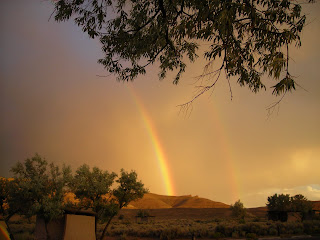
Silver Fox has posted some rainbow pictures, from the Great State of Nevada, so I thought I'd show some Wyoming pride. Below are some pictures from the summer, showing rainbows leading to a sedimentological pot-o'-gold (the Green River Fm):
And finally, a double rainbow!
Wednesday, October 29, 2008
Small World Photography
Microscopy plays a big part in geology, whether it's picking out forams for biostrat, describing microfacies in carbonates, point-counting grains in a sandstone, or identifying metamorphic mineral assemblages. But along with the academic value of microscope work, I think we can all appreciate the aesthetic beauty of these micro-worlds.
I recently ran across the Nikon Small World contest, which allows people to submit photomicrographs of really small stuff, which are then judged on their beauty and composition. There 2008 winners (and honorable mentions) are up, and show lots of really cool images of a variety of subjects. Unfortunately, I didn't see any strictly geological examples out there, which is a shame; you'd think someone would have a picture of a schist with crossed polars out there! I think the 2009 competition needs some geo-representation.
Anyway, I nabbed a few of the really slick ones from this year for your viewing enjoyment.
This is a cute little diatom, just kicking back and relaxing on a branch of red algae (100x):
I think diatoms must be a favorite, since there are several of them; here are some, along side some Closterium and Spirogyra (40x):
Showing some silacecous love, here are some radiolarians (160x):
More diatoms (100x):
And, finally, something near and dear to grad students everywhere, caffeine crystals (400x):
Sunday, October 26, 2008
Just in Time for Halloween: A New Paleozoic Sea Level Curve
Sequence stratigraphy, regardless of what one thinks of the specific methods, has played a major role in fundamentally changing the way we look at the stratigraphic record. It's a major conceptual framework that helps us interrogate the "time-as-rock" and "time-as-surfaces" relationships represented by the stratigraphic record, and has served as the dominant correlation strategy for much of the community of working sed/strat types.
So it's kind of a big deal.
Historiographically, the central concepts of the practice began with the work of Suess (1906), Blackwelder (1909), Barrell (1917), Wheeler (1958; 1964) and Sloss (1963). Despite these early works, however, "sequence stratigraphy" is represented (for good or bad) by the iconic 1977 AAPG Memoir 26, which brought the Exxon-ian Depositional Sequence to the conceptual and terminological landscape. And of all the contentious terms and ideas put forward by subsequent seq. strat. workers, perhaps none is more (in)famous than the dread Eustatic Sea Level Curve.
Eustatic sea-level curves have been used and abused in a variety of ingenious ways, and the literature is full of delightful arguments as to their merit and meaning. Sea-level curves are a complicated theoretical construct that really requires some serious and thoughtful interrogation. Or, alternatively, Sea-level curves are things you put up on the wall, and then match your particular rocks to your favorite wiggle. The community is divided as to which approach is correct.
Anyway, Haq et al. (1987) published the seminal Sea Level Curve for the Triassic and Younger; now, Haq and Schutter (2008) have put out a Paleozoic Sea Level Curve for our consumption. The paper, published in Science, is available here. The real meat, including a pretty graph, is located in the Supplemental Online Text (SOM), available here.
Haq and Schutter (2008) produce a series of designated "Reference Districts", which in reality represent composite stratigraphic sections for the time intervals in questions; this is a necessity, as Paleozoic rocks are commonly seriously eroded and possibly deformed, required multiple stratigraphic sections to transect a larger chuck of time. These reference districts span the world, and are taken from the literature; the SOM details these and their references. Additionally, the authors identify Ancillary Sections, which are not in Reference Districts, but show the same interpreted sequences and surfaces.
Anyway, without further ado, below is their pretty Paleozoic Sea-Level Curve; both the figure and text are from the SOM to Haq and Schutter (2008):
To summarize the curve, Haq and Schutter identify a long-term sea-level trend that shows a gradual rise through the Cambrian, a zenith in the Late Ordovican, a rapid, short-lived sea-level low related to Hirnantian (~445 Mya) glaciation, with subsequent (though smaller) highs in the mid-Silurian, the Middle/Late Devonian, and in the Latest Carboniferous, and lows interpreted in the early Devonian, the Mississippian/Pennsylvanian boundary, and in the Late Permian. Overall magnitude of the 170+ eustatic events is interpreted by the authors to range from a few meters to ~125 m.
The authors do acknowledge a couple of potential issues with their work: first and foremost, they are very up-front about the difficulty of interpreting magnitudes of change from the rocks, particularly from aerally disparate outcrops with often complex unconformity relationships. The authors also recognize the difficulty of chronostratigraphic and geochronological calibrations, particularly given that the biostratigraphy of these sections is often complex and dominated by endemic, restricted faunas.
Haq and Schutter also cut-off one of the loudest (and, in some ways, most damning) criticisms made for the Haq et al. (1987) curve: the availability for reexamination of the data used in the analysis. The Triassic and younger curve was commonly criticised for the proprietary seismic data used to calibrate coastal onlap; in other words, you kind of had to take the authors' word on their interpretations, because Exxon sure wasn't going to hand over the data. In this 2008 paper, however, Haq and Schutter make a special point of noting that these sections are "public-domain", in that they are freely accessible to other workers who want to go look at them.
Admirable though that recognition may be, the fact of the matter is that this opens up other problems. Namely, this work is a meta-analysis, and therefore, subject to all the prejudices and problems that sort of broad-brush examination are subject to. In the SOM, Haq and Schutter cite 82 primary sources for their Reference Districts (which form the core of their interpretations), and a subsequent 192 for their Ancillary Sections. While that's a lot of papers, a perusal of the work shows a dominance of North American sections, with Australian sections coming in a close second. The statistical significance of the dataset is therefore complicated by the geographic and temporal distribution of the sections, which are already on the low end for a global synthesis anyway. At some point, we as a discipline are going to have to ask ourselves about the suitability of meta-analyses for geological or stratigraphic studies.
Furthermore, the old "tectonically quiescent" thing is a problem, particularly given the publication of a couple of papers that specifically refute the existence of such settings at the applicable time-scales (specifically, Cogne and Humler, 2008 and Moucha et al., 2008, both in EPSL). The argument for these settings always comes off as a little circular: we get a eusatic sea-level curve, so these settings must be tectonically quiet, right? Given the problems with actually backstripping some of these settings (which, to their credit, Haq and Schutter do acknowledge), the attribution of accommodation creation to eustasy seems suspect.
The biggest potential hurdle, to me at least, seems to be deconvolving the accommodation curve from the sediment supply curve; simple changes in sediment delivery to the coast can produce a coastal onlap curve. Without at least mentioning it, let alone actually interrogating the potential impact on your curve, I really can't suss out how important a factor it is in your sections. This was the point of Christie-Blick (1991), which seems to be a constantly unanswered challenge to these onlap curves.
There is obviously a very interesting story to be found in the record of Phanerozoic sea-level changes; the fact that many of these studies have found inexplicable high-frequency, high-magnitude changes during decidedly non-glacial phases suggests that there are still poorly understood depositional and stratigraphic principles out there (though these MAY be of the sed supply:accommodation ratio nature, rather than any crazy unknown water cycle issue). Also, the utility of accurately and unequivocally pinning down the history of eustatic sea level changes has important implications across a variety of earth science disciplines. Here's hoping that this work re-energizes the community!
Saturday, October 25, 2008
Tree vs Rock
The eternal struggle between rocks and their mortal enemies, plants, continues in the battleground of Providence Canyon, GA.
Trees!
Geotripper shared a picture of a lovely, Middle-Earthish tree in the midst of Yosemite Park, while Clastic Detritus showed a picture of some Brushy Canyon vintage Madrone, so I reckon I'll just share a picture of my favorite tree: The Juniper.
I like junipers for two reasons. One, if you see them, then you are Probably somewhere close to some good rocks, which is always good news.
Second, I like Junipers because you can make gin from their berries.
Junipers: are they the best trees? They just might be.
EDIT: Holy Smokes! So Many Pictures of Trees!
Monday, October 20, 2008
Neoichnology II: Revenge of the Scorpion
While organizing my geo-picture collection, I ran across a Death Valley picture I hadn’t shared that ALSO tied in with the whole neoichnology trend from yesterday. The picture below is from the dune field in Death Valley, and shows a scorpion track left in a fine-grained sand substrate:
You can see the somewhat confusing scratch marks along either side of the trail; I guess having several pairs of legs skittering away all at once makes for some convoluted footprints. The central furrow in the trackway is from the tail. I’ve been told, though I’d have to look up a cite to be sure, that scorpions commonly only produce tail-dragging marks at night (or when it’s cool and shady), and will hold their tails up off the ground during the day. Thus, in SOME cases, you might be able to tell whether it’s night/day in the rock record depending on the scorpion trace fossil.
Seeing this picture again reminded me of a paper I had read a while back. Davis et al. (2007) wrote up a pretty nice summary paper of some experimental work on the neoichnology of some modern terrestrial arthropods. The point of their work was to investigate the effect of substrate conditions on both the morphology and taphonomy of the resultant traces. They used a variety of trace-making bugs (including Giant African Millipedes, Cockroaches, Tarantulas, Woodlice, and some Emperor Scorpions) to investigate the generalized range of bug bauplans, and they used a range of grain-sizes and moisture content to simulate varying substrate conditions, producing two taphoseries: A dry- to dampground series, meant to mimic fully subaerial conditions, and a soft- to firmground, meant to mimic a transitional state similar to a recently flooded overbank setting.
The approach used to produce the substrates was one I had never encountered in the literature before, and seemed fairly rigorous. For the subaerial setting, they simply sprayed an amount of water onto the substrate, and then the critter walked across it. For the transitional setting, though, they put 2 cm of sediment into the tray, removed it, filled the tray with 2.5 cm of water, and then sprinkled the sediment back into the tray. After allowing it to stand overnight, the siphoned off the water, and then proceeded to dump the animals into the experimental setup at regular intervals after the siphoning (0 mins, 60-75 min, 120-150 min).
The picture below is taken from Davis et al (2007; p. 292), and shows the dry to damp series for the Scorpion:
This picture is from Davis et al (2007; p. 293) and shows the soft- to firmground series:
The authors conclude that the increasing firmness of the substrate, related mostly to moisture content, exerted the largest control on the resultant morphologies. Overall, the authors saw a decrease in track width (or track row width) with increasing moisture. They also found, unsurprisingly, that big heavy animals make the best, most preservable trackways in these conditions.
The potential utility of the work is pretty interesting: maybe we could make interpretations of substrate moisture content, qualitatively at least, in some very special trackway settings, letting us get into some nitty gritty paleoenvironmental interpretations. Of course, all the old caveats would apply, least of which not being the fact that we don’t really KNOW how big the animal was or its specific physiology. Still, Davis et al. (2007) suggest a good starting point for this sort of work, and I think make a good case for the importance of careful neoichnological research and its potential impact to sedimentary geology.
WORKS CITED:
Davis, R.B., Minter, N.J., Braddy, S.J., 2007, The neoichnology of terrestrial arthropods: Palaeogeography, Palaeoclimatology, Palaeoecology, v. 255, p. 284-307.
Sunday, October 19, 2008
Neoichnology
Wandering around the autumnal woods here, I ran across a muddy little puddle that had been visited by at least a couple of different kinds of critters. You can clearly see the weird, hand-like footprints of a raccoon, as well as a the huge footprint of an extant therapod known for it's deliciousness (a turkey). Beercap I had in my pocket for scale.
This little puddle must have been a busy place; lots of animals had stopped by for a visit. Of course, if I was feeling snarky, I might make a joke at the expense of some dinosaur track people (about the Raccoon actively stalking the turkey, who had fled in terror from its masked foe). But, I'm not felling snarky, so I won't.
On an unrelated note, is it just me, or does everyone else out there ALWAYS want to somehow ensure animal tracks get preserved? Like dump a bunch of sand on em or something, so they enter the record. Whence comes this weird compulsion, I wonder?
Tuesday, October 14, 2008
OzCoasts
For a bunch of debtors and criminals, those Australians can put together some slick online Sciencey type resources, man. I just found this online: OzCoasts, which is a huge database of coastal environments, including much of the geomorphic, meteorological, biological, and geological data from something like 780 coastal waterways in Australia. These data are all searchable, so it seems to be a pretty powerful set of tools for looking at a variety of environments.
They also have a pretty impressive library of general block diagrams and coastal system models, tailored for specific settings, and detailing any number of attributes, including hydrodynamics, depositional environments, and critters living in the setting. Furthermore, you can make your own block diagram, which is actually a pretty handy little tool for quickly whipping up a diagram for class. There are also whole lot of "Coastal Indicator Factsheets", including sections on sea-level rise, sediment quality, and habitat issues (among other things).
Also, they have some very nice interactive 3-D models of several localities, including Cockburn Sound and Sydney Harbor, which are both areas where a lot of work has been done. These maps include CHIRP derived bathymetry and sub-surface data, as well as details on grab-cores and samples from these localities.
All in all, there is a lot of stuff to look at on this site, and it would serve as a nice model for other databases for other geographic (or geomorphic) settings. Someone should really get on that.
Anyway, just so this isn't only text, here's a picture (from NASA WorldWind) of the Gascoyne River Delta:
And here's an unknown river a little south of the Gascoyne, winding its way through some dunes.
Apparent Dip: Blog of Note
Congratulations to Apparent Dip, who is the "Blog of Note" as awarded by Blogger for October 14, 2008. Now that you're famous, I hope you can still find the time to blog...
I wonder what you win?
Saturday, October 11, 2008
Fish Five Miles Down
The "deepest ever fish on film" was mentioned on the NPR website recently, and I thought I'd pass it along so that everyone could start celebrating early. The fish, a Liparid (or Snailfish) lives at around 7,700+ meters (that's nearly 5 miles) down in the Japan Trench.
The footage was taken by a "free-form lander", which is described in the news story as being some sort of a lunar lander type of device that they just hork off the side of the ship and come back for later. It's a weird looking fish, and some of the footage is available for viewing.
Thursday, October 9, 2008
Wyoming Vista
Tuesday, October 7, 2008
Earth Science Literacy
So the first Draft of the Earth Science Literacy Document is up and available for comments (right...HERE). This is an NSF-supported effort meant to explicitly spell-out the state of our knowledge of the Earth in a way that everyday, non-specialist citizens can understand. Effectively, it's a list of the Things Folks Should Know About the Earth, and is meant to go along with all the Ocean, Climate, and Atmosphere Literacy work that was recently undertaken.
Anyway, the document identifies 8 Big Ideas in the Earth Sciences, which I've summarized below. These ideas are supplemented by a series of Supporting Concepts that flesh out the overarching concept. The 8 Big Ideas (paraphrased) are:
1) Earth is 4.6 Ga, and the rock record contains its history.
2) Earth is a complexly interacting system
3) Earth is a continuously changing planet
4) Earth is the Water Planet
5) Life evolves in concert with the evolving Earth, and similarly modifies and effects the Earth in turn.
6) Humans depend on Earth for Resources
7) Earth Science helps us understand and mitigate natural disasters
8) Humans are a significant agent of change on the Earth
It's a pretty nice list, in my opinion, and would make a great hand-out in an undergrad intro class. I also like how the foundational concepts of Plate Tectonics and Evolution are distributed throughout the supporting points, driving home the unifying power of both of these fundamental concepts.
The only (vague) comment that I have would be that I'd like to see maybe a little more about radioactive decay and radiometric dating. Maybe not as a BIG IDEA, but as another supporting point (somewhere, maybe under #1?).
Importantly, this is only a draft, and if you've got any concerns or issues or burning bits of illumination to add, we have until Oct 31 to make comments, so get to it!
I'd also be more than happy to hear what you guys think about it too, of course.
EDIT: Here are some links to chew on! The Ocean Literacy Network, and their Ocean Literacy Statement; The Atmospheric Science Literacy Framework and their Statement; and the Climate Program Network, and their statement! Whew! That's a lot of statements!
Community Sedimentary Model for Carbonate Systems
I'm sure everyone has already read up on the CSDMS from the most recent "Sedimentary Record", but I thought I'd post a link to their website right here. It has some fairly slick pdfs of the talks, posters, and Working Group Summaries, which make for some pretty nice bleeding-edge "State of the Strata" resources for Carbonate naifs (like myself). Though it's not up yet, the Group says they hope to have a PDF copy of the resultant white paper up soon, so stay tuned!
Thursday, October 2, 2008
Sarah Palin - Dinosaur Rider
Ron Numbers, a scholar who studies the History of Science and Religion, and author of The Creationists, has a pretty nifty little assessment of Palin's creationist bullshit.
Enjoy!
Enjoy!
Wednesday, October 1, 2008
Kinematic Theory of Unsteady Seperation
One of the problems with so much of our understanding of hydrodynamics (and, more broadly, all Earth Processes) is that we have to make so many damn generalizations and simplifications. Of course these are important first steps in developing greater insight into the world, but sometimes, you just want to have a firm grasp on what the hell is going on, you know?
Two recent papers, Weldon et al. 2008 and Lekien and Haller 2008, have made some impressive advances in our ability to describe and predict flow separation under unsteady conditions; the ramifications of this are pretty big, and if you've got a secret love of hydrodynamics (like me), it's pretty exciting stuff!
Fundamentally, flow separation occurs where a fluid is moving away from a solid boundary of some sort. In sedimentology, this is commonly illustrated by the behavior of a fluid flowing over a bedform, such as a dune in a river. While we have always had a general, qualitative appreciation of the effects of flow separation on bedform dynamics (i.e., back-flow eddies in the lee-sides of dunes, Kelvin-Helmholz instabilities in turbidity currents, etc), a quantitative description of the behavior has been lacking; as such, modeling these systems is difficult, and requires some arm-waving.
In fact, the nearest thing we've had to a kinematic solution for flow separation was Prandtl 1904. Using some mind-bogglingly complex math, ol' Prandtl was able to come up with a solution for laminar boundary separation in steady 2-D flows. Sentences like the previous one make sedimentologists involuntarily twitch: "laminar" and "steady" are both exceedingly rare in the natural world, making Prandtl's work useful for gross generalizations, but frustratingly weak in unsteady and turbulent flows.
Now, however, Weldon et al. and Lekien and Haller have both shown numerical and -most importantly- EXPERIMENTAL data that advances a kinematic theory of unsteady separation, allowing us to accurately predict separation points in unsteady flows. Furthermore, part of Weldon et al. (2008)'s work has shown that their kinematic theory accurately predicts flow separation in flows that are kinematically equivalent to turbulent flows.
Lekien and Haller (2008) also apply this particular kinematic theory to boundary separation models of the North Atlantic geostrophic current AND to boundary current separation and reattachment in Monteray Bay, based on field data collected from real live currents.
The public take on this (see here for MIT's own press release on the research) is focused on larger, non-geologic issues, such as increasing fuel efficiency by decreasing shear drag on cars. However, for selfish reasons, it will be particularly exciting to see where this sort of research leads to in the sed realm. We might finally start to home in on some robust models of mixing layer dynamics in sediment laden flows, or even (bestill my heart!) start being able to really interrogate bedform morphodynamics and evolution under realistically complex flow conditions!
WORKS CITED:
Weldon, M., Peacock, T., Jacobs, G.B., Helu, M., and Haller, G., 2008, Experimental and numerical investigation of the kinematic theory of unsteady separation: Journal of Fluid Mechanics, v. 611, p. 1 - 11.
Lekien, F., and Haller, G., 2008, Unsteady flow separation on slip boundaries: Physics of Fluids, v. 20
Tuesday, September 30, 2008
New Sed Blog!
Enough of that politcs stuff! Behold, fellow blog-o-nauts! A NEW SED/STRAT/PALEO BLOG THAT I HAVE RECENTLY BECOME AWARE OF:
Sed-Line News
With every new blog, we come closer to the eventual Scientocracy!
ALSO, it is powered by Wordpress, so Brian over at Clastic Detritus should be happy.
Sed-Line News
With every new blog, we come closer to the eventual Scientocracy!
ALSO, it is powered by Wordpress, so Brian over at Clastic Detritus should be happy.
Fire walk with me
"Fellas, coincidence and fate figure largely in our lives" - FBI Special Agent Dale Cooper
Delving deeply into the various forbidden branches of human and inhuman knowledge (as we graduate students are, by necessity and temperament, often wont to do) can have unforeseen consequences, the least of which not being that the maddening truth may often be brought forth into the harsh light of our awareness. In such cases, only the nepenthe of true insanity can save us.
Behold, if you dare, the horribly revealed truth of such dark illuminations as I have known:
Sarah Palin looks ALMOST EXACTLY like Laura Palmer! It's uncanny! The same vacuous stare, the pained grin, the tower of hair. And if you think about it, the potential VP has a lot more in common with the horribly murdered small-town girl from Twin Peaks. Both were beauty queens, both had a crippling coke habit, both are subject to cosmically evil forces beyond the ken of Man.
I think I may be on to something.
Watch the Owls; they are not what they seem...
Monday, September 29, 2008
Banned Book Week
This week, Sept 27 - Oct 4, is the American Library Associations' Banned Books Week, where all freedom-loving patriots in this country should reaffirm their staunch support of intellectual and literary freedom. Banned Book Week has been celebrated since 1982, and serves to fundamentally remind us that, though every book may not be for everyone, we have the personal choice to right to access any written material we may want. You can access a list of the most frequently challenged books right here.
Note something about that list. The old standbys are there, of course: Slaughterhouse Five (for portraying war and murder in an unpatriotic light), Huckleberry Finn (for racism, which just goes to show you don't have to understand and idea to hate it), and everything Toni Morrison ever wrote, including grocery lists and post-it notes. Having these books on the list is no surprise, but what may come as a shock is the large number of Kids Books on the list, particularly those that seek to advance a view point of tolerance and acceptance of those different from ourselves. I wonder if it is the topic these folks find offensive, or is it the acceptance that is so verboten?
As scientists, science-enthusiasts, or just your basic good-hearted sorts, we can all appreciate the importance of fostering a diverse assemblage of worldviews in a publicly accepting and understanding intellectual environment. As such, we can all appreciate the importance of observing banned book week in principle. However, this year's Banned Book Week coincides rather nicely with something of equal, and not unrelated, importance.
That's right; on Thurs, 2 Oct, the VP debate is slated to begin. And Sarah Palin, the barely literate, fundie-wackjob of the season is going to get a public forum to spew her particularly noxious brand of conservatism. As part of her proud, neo-con CV, Palin tried to fire librarians and get some books banned in her home state of Alaska.
You know who else likes to ban books, Sarah Palin? Terrorists. And Nazis. And Fascists of all stripes. So, as a generalization, I think we can all agree that people who like to ban books are Assholes.
Sarah Palin is an Asshole.
So I encourage everyone to support the Banned Books Week in any way they can, most importantly by taking some time out to read a banned book. Because every time you read a banned book and exercise your rights as a citizen, Sarah Palin cries.
AND, if you need more proof (presented in a hilarious format) that Sarah Palin is batshit crazy evil, take a gander at the clip below (warning: there is some blue language):
Tuesday, September 23, 2008
Isotopes and Paleodrainage
Isotope geochemistry is one of those sexy topics that has captured a lot of attention in the past decade (or more), and some of that attention is even deserved (oh! Burn on Isotopes!). Isotopic records have proven to preserve interesting, if sometimes occult and difficult to interpret, patterns of change from many different depositional environments and basins. Often times, these records are used in the dark arts of paleoclimatology, where it is hoped that temperature driven isotopic fractionation can be parsed out from authogenic minerals.
However, there are alternative mechanisms for getting different isotope values into a basin. Very recent work (it came out today) by Carroll et al. (2008) attempts to link isotopic changes preserved within some of the Green River lacustrine strata with evolution of the drainage system in the hinterland. Basically, these authors attribute changes in O and Sr isotopes to drainage capture of high elevation sources in the Cordilleran foreland system.
Lake Gosuite was a Big Ass Lake (BAL in the technical parlance) in the Eocene of southwestern Wyoming; the resultant stratigraphy of these deposits is actually incredibly complicated and cool, though Carroll et al. (2008) focus on the specific interval that saw the deposition of the LaClede "Bed", which are actually a group of related, carbonate rich bedsets that record alternate phases of lake expansion and contraction.
Anyway, previous work in the basin has identified a distinct stratigraphic surface, the "fill to spill surface", across which a considerable change in isotope values in preserved. The figure below is from the Carroll et al. (2008) paper, and is their Figure 2 (on page 792).
What the figure shows is a rapid decrease of delta 18 O values for this interval, dropping from ~+26 parts per mil to ~+20 parts per mil in the Upper LaClede Bed. A concomitant decrease of Sr isotopes, from 0.712296 +/- 0.0004000 to 0.711638 +/- 0.000274 is also recorded (page 792 of Carroll et al. 2008). What could have caused such a dramatic change (the authors are glad you asked)?
Diagenesis is ruled out, on the basis of a lack of textural evidence for alteration in the mudstones. Furthermore, widely dispersed outcrops record the same shifts in O and Sr isotopes. Additionally, diagenesis would be expected to have produced lower delta 18 O values than reported by Carroll et al. 2008. The authors conclude that this is not a diagenetic signature; so what is it?
One explanation is a direct change in climate in the basin, such as wetter conditions in Lake Gosiute. However, based on Carroll et al. (2008)'s mass balance model, a shift of the magnitude reported above would require a 4x increase in precip OR a 50% decrease in evap (or some combination). The problem with this idea, however, is that there is no sedimentological OR paleontological/paleobotanical evidence for such a dramatic climatic change at this time.
The authors conclude that a more probable explanation is river capture of a more northernly drainage, with differently sourced waters bringing in different isotopic values into the basin. This is supported by the fact that, simultaneous with the change in isotope values, is an increase in volcaniclastics (probably sourced from the Idaho and southwestern Montana volcanic fields) within the basin. By simply capturing a river that might be sourcing a higher elevation, the resultant system could dramatically change its isotope value without having to undergo some sort of huge climate shift.
It is an interesting read, and suggests that the record of climate, as derived from isotopes, may be complicated by more processes than previously recognized. Similarly, it makes me wonder about paleoaltimetry estimates; could those records be affected by the size and source of the drainage in the adjacent sed/water delivery system?
WORKS CITED
Carroll, A.R., Doebbert, A.C., Booth, A.L., Chamberlain, C.P., Rhoades-Carson, M.K., Smith, M.E., Johnson, C.M., and Beard, B.L., 2008, Capture of high-altitude precipitation by a low-altitude Eocene Lake, western U.S.: Geology, v. 36, p. 791-794.
Friday, September 12, 2008
The Cave of Lascaux
Today, September 12, is the 68th anniversary of the discovery of the famous cave paintings at Lascaux, France. These 16,000 year old cave paintings are really pretty spiffy, and include over 2000 individual paintings of figures, including Bulls...
...Horses...
...and a strange bird-headed man being charged by a Bull. Note the Rhino in the lower left of the picture below (scientific fact: Rhinos are cool).
The Cave was discovered by four boys out for a jaunt in 1940. It has since become one of the most important Paleolithic sites in the world, and was declared a UNESCO World Heritage site in 1979. There is a pretty slick Lascaux Website run by the French Ministry of Culture that has lots of pretty pictures of the cave art, and more info about the research that has gone on there.
Everybody should go out and kill a mammoth in honor of their ancestors today; barring that, I guess drinking a beer in their honor would be alright, too.
Wednesday, September 10, 2008
Burrowing Mechanics
It's International Trace Fossil Day (not really), so let's talk about bioturbation!
One of the perennial problems with animals burrowing into sediment has been the presumption that, energetically, it is way more costly than walking, running, swimming, or flying, especially when you are burrowing into cohesive sediment. As such, it has always been a little tricky to understand why any critter would be willing to expend so much energy in evolving into a benthic bioturbator. Additionally, part of the problem seems to have been that physically studying the energy use of a burrowing critter in situ is a bit tricky. As such, folks in the past used Newton's Third Law as an assumption, and always seemed to come up with burrowing as a very high cost (metabolically) biological activity.
However, some fairly recent studies by Dorgan et al. (2005) and Dorgan et al. (2007) have overturned some of these assumptions through novel and (to me, at least) insightful experimental design. To give away the punch line, burrowing is actually much easier than we had previously thought, since animals can use crack propagation to move through muddy sediments, expending much less energy than the previous models of whole-animal burrowing indicated.
First off, both of these papers point out that previous studies of animal burrowing always took place with the animal near a rigid wall (like the transparent edge of an aquarium); as such, the animal behavior exhibited was not, energetically, the same as moving through deformable sediment. In order to overcome this wall effect, the workers used a transparent gelatin as their muddy sediment analog, which has similar mechanical properties to marine muds. Also, and this is the slick part, gelatin is birefringent, meaning that the workers could look at it through polarized light and clearly track the deformation occurring around the critter AS IT HAPPENED. Nifty, huh? The picture below (and the caption) was seized from the Dorgan et al. (2005) paper.
The worm (Nereis virens) moved through the gelatin by exerting a dorsoventral force against the walls of its burrow, resulting in an oblate hemispherical crack; stresses are concentrated at the tip of this crack, and exceed the critical stress needed for the crack to propagate. In otherwords, the worm creates a wedge-driven fracture (like an axe being struck into a log), rather than actively excavating a vacuity in the sediment. The picture below, also from the Dorgan et al. (2005) paper, explains the whole process visually.
The results of this study match (or exceed) modeled critical intensity stress values for sediment, suggesting that crack propagation processes are a viable burrowing mechanism. It's a pretty slick study, I think, and shows how some of the benthos may do their burrowin' in the sediment.
WORKS CITED:
Dorgan, K.M., Jumars, P.A., Johnson, B., Baudreau, B.P., and Landis, E., 2005, Burrow extension by crack propagation: Nature, v. 433, p. 475.
Dorgan, K.M., Arwade, S.R., and Jumars, P.A., 2007, Burrowing in marine muds by crack propagation: kinematics and forces: The Journal of Experimental Biology, v. 210, p. 4198 - 4212.
Friday, September 5, 2008
Monday, September 1, 2008
Greater Green River Intergalactic Spaceport
Howdy folks; well, the field season ends, and the semester begins, thus continuing the eternal cycle of academia, red in tooth and claw. It's always tough to leave the solitude of the field, but, such is life. It's especially tough to leave Wyoming, a state known for having a pretty rich crazy-to-citizen ratio.
The town of Green River has its very own "airport", just like it's rowdy, ne'er-do-well bigger brother to the east, Rock Springs. But, where the Rock Springs Airport is all glitzy and "show-business" (having obviously left its small-town, simple-livin' ways behind it), the Green River keeps true to the honest, western simplicity that made this country great. Eschewing new fangled concepts like "asphalt", "radio", or "buildings", the Green River airport is a simple dirt track, located a few miles south of the (mormon-)God-fearin' town of Green River proper.
Also, the airport is officially named "The Greater Green River Intergalactic Spaceport," in honor of the wind-driven madness that has affected Wyoming lo these many years. You can check out the official listing for the airport right here.
Of course, having been out in the wilds of Wyoming for months, I too was driven mad by the stark beauty of the windy high desert, so I deliberately went out to find the Spaceport, and provide some pictures for you.
The picture above is the only man-made structure at the spaceport, a windsock and windsock pole.
This picture looks North, up the gravel runway.
This picture looks South, down the gravel runway.
I felt closer to the cosmos just standin' there; we must all do out part for intergalactic peace and goodwill, even with the dastardly Reptoids of Alpha Draconis.
Tuesday, August 19, 2008
I Am A Dashing Sky Pirate
Howdy folks! A quick post (Hey! I'm a busy sky pirate!) to put some more of the aerial photos up for bloggy consumption.
The picture below this sentence shows the alluvial/fluival Wasatch Fm, underneath the whitish-tannish lacustrine/fluival Green River Fm.
The Green River (in the pic below) has done yeoman's work in Wyoming, having eroded down through much of the sediments, exposing these strata for study. I plan to acknowledge the river in the dissertation, so don't worry.
Here's some more of the red Wasatch Fm, with some of the overlying Green River Fm exposed.
Just to show some Mesozoic love, here is some of the shoreline sandstones of the Ericson Ss, exposed a little to the east of Rock Springs.
And speaking of the Mesozoic, here is the Rock Springs Airport, sitting on a resistant turbidite of the Cretaceous Baxter Shale, as we come in for a smooth landing.
Subscribe to:
Posts (Atom)