THE DYNAMIC EARTH: A BLOG ABOUT GEOLOGY AND THE EARTH SCIENCES

Sunday, April 29, 2012

1906 San Francisco in Ruins - Zoomable!

Man, I hate to bring folks down, but take a look at this - the USGS has rephotographed George Lawrence's famous photo of the ruins of San Fran taken just a few weeks after the famously apocolyptic 1906 earthquake.  Super high resolution and completely zoomable, it is really a pretty amazing piece of work.  

The picture, zoomed out, looks thusly:

 But, zoomed in:


Pretty awesome stuff, and kind of hard to comprehend the complete destruction.  Anyway, you can find the image and info regarding how it was updated and digitized here.

Saturday, April 21, 2012

Sandy Troughs!

All this nice weather is makin' me hanker some field work!  Instead, I wither away, chained to the ol' Word Processor, processin' words.  Oh well.

However, a few of us grad students were recently able to slip off for a little local rock hammering.  An old railroad cut here in town actually chops right through some pretty awesome Ordovician sandstones, actually providing some pretty okay exposure, for the midwest.  These sandstones are stupid-rich with well sorted, well rounded, upper-medium quartz grains; despite this, there's actually some pretty decent sed structures to enjoy, accentuated by weathering.


 The picture above shows some fairly nifty cross-stratification.  Don't be tricked by the apparent bi-directionality of the cross bedding, though! These are trough cross-stratified sets, formed by the migration of sinuous-crested 3-D dunes.  Paleoflow is actually broadly oblique into the picture, with troughs chopping into each other at slightly different angles. 

The picture below is a close up of the juxtaposition of two different sets of cross-strata.


If you're not careful, you might interpret these structures as herring-bone cross-stratification, which would imply a tidal sort of paleoenvironment dominated by the bidirectional ebb- and flood-tidal cycles.  However, as you can see in the picture above, and with some careful observations on the rocks, the apparently different directions are actually just obliquely cut troughs, with the internal cross-laminae conforming to the immediately local conditions formed by the variable geometries of individual dunes spilling into the erosional scoops forming on their lee-side.  Careful paleocurrent measurements from these rocks would actually show a fairly consistent and unidirectional suite of directions, with no evidence of tidal back-and-forth. 

To be honest, I've never actually seen ANY convincing "herring-bone" cross-stratified sandstones; EVERY example I've ever been shown in the field turned out to be, upon closer and more careful inspection, the result of obliquely flow-perpendicular exposures of troughs.  I'm not saying that herring-bone x-strata don't exist, but just that they're probably grossly over interpreted.  A little careful, nose-on-the-rocks geology will rapidly disabuse us of our misapprehensions.

So don't be tricked by crafty sed structures!  Do as the geologists in the picture below, and get on those rocks!      

Wednesday, April 18, 2012

Real Time Wind Map!

Whew!  Kinda quiet in these here parts, on account of my tryin' to WRAP THIS NONSENSE UP!  Writing, writing, writing, and more writing, which leaves precious little time for some of that sweet sweet bloggin.  Anyway, here's something totally awesome for you guys to enjoy: a real time wind map for the US! 

The folks that put that map together are interested in innovative data visualization techniques, and you should check them out for some totally rad ways of communicating awesome stuff.  Enjoy!

Now, back to work!

Wednesday, February 29, 2012

Leap Day Soft Sediment Deformation!

Pretty busy here...lots o' writtin', lots o' workin', and even a little bit o' thinkin' going on.  Anyway, I really just wanted to grab a Leap Day post, so here's a picture of some rad soft-sed deformation from the Wilkins Peak arkosic intervals in SW Wyoming.  Enjoy!


Back to work!

Wednesday, February 1, 2012

50 Most Loathsome Americans List!

It's here!  The crafty bastards at the Buffalo Beast have finally released their annual list of the 50 most loathsome Americans!  Go and READ IT now!  Who knows; maybe you made it this year!?!

Sunday, January 15, 2012

Sed Structure Sunday - Adhesion Ripples!

As previously mentioned, my visit to Sandy Hook in New Jersey was on a pretty damn windy day.  Big, 40 mph gusts were walloping the beach, coming in obliquely off the sea an onto the sandy foreshore.  These winds were mobilizing a LOT of material, saltating medium-grained sands along the damp shoreline, producing a perfect opportunity to catch some pretty neat eolian sedimentary structures.  Behold!  Adhesion Ripples (Camera case for scale)!


Adhesion ripples are formed when dry, wind blown sand gets glommed onto a wet, sticky surface; the fancy word for such glommification is "adhesion", et viola: Adhesion Ripples!  They differ from the traditional ripple cross-laminated sands in a variety of important ways, the most fundamental difference being that there isn't any evidence for the traditional grain-flow structure in the laminations, which would be expected if these structured formed as part of a migrating bedform.  More qualitatively, these structures just seem weird, with chunks and bits stuck onto a wavy surface in a way that just LOOKS different from the directional migration of sedimentary structures.

Kocurek and Fielder (1982) elucidated their genesis through a variety of flume/wind tunnel experiments, and also noted their occurrence in ancient eolian deposits.  In fact, the same quarries that produce the jellyfish impressions in the Cambrian of Wisconsin ALSO produce some pretty nice examples of adhesion ripples.  These are actually pretty handy structures, and have been used as evidence for a subaerial phase in some of these enigmatic mid-continent sandstones everyone seems to fond of.

Anyway, a little known but potentially quite helpful sedimentary structure to keep in mind when out looking at the rocks!

Friday, January 13, 2012

Crab Pavement!

Day three of our "dead beach stuff" marathon here at the ol' Blog; you can catch up on all the grim action on these previous posts.  Anyway, today's litore mortem comes again from the Jersey coastline at Sandy Hook.  It was a blustery day, with 40 mph gusts along the shoreline, and very very very cold.  Anyway, the wind was SO strong, it was pretty actively entraining some sand, leaving behind only the largest clasts, including...a whole bunch of dead crabs!


These crabs were littered everywhere, and the aeolian evacuation of sand was leaving behind the crustaceans to form a nifty little crab-enriched interval.


Gruesome, ain't it!?!


Sometimes, the crabs were serving as baffles to the blowing sand, like this little guy below:


Nifty!

Thursday, January 12, 2012

More Dead Things on the Beach!

Continuing the trend from yesterday, here's another picture of some dead stuff I found on the beach over the holiday break!  We've moved out of the Gulf and onto the Atlantic coast, and a far bit more northward as well; these pictures are from Sandy Hook, off the coastline of New Jersey.  It's a ray, washed WAAAAAAAY the hell up on the backshore during a pretty tremendous storm that hit the Atlantic coast.


And here's the poor critter, flipped over.


Wednesday, January 11, 2012

Jellyfish on the Beach

The shoreline is always a fun place to visit; not only is it a picturesque confluence of all sorts of sedimentary and geomorphic processes mingling and interacting with on another, but there's all sorts of wiggy critters and nifty biology to see as well.  Over the break, I had the chance to spend a lovely day at the beach on St. George's island, a barrier island in the Gulf of Mexico not too far from the Oyster Capital of the Gulf, Apalachicola Florida.  Some recent storms had stirred up the shoreface a bit, resulting in some pretty nifty shell hashes and fragments scattered all over.  However, along with the biomineralized detritus cast up by storm waves, there were also a  fair number of these guys:


Jellys!  Subaerially exposed!  Some of these, like the one in the picture above, were exposed in the littoral zone, but a few of comparable size had been chucked up pretty far onto the beach, out of range of fairweather wave activity.  Always fun to see cnidarians, especially when the chance of getting stung in minimal.  Anyway, seeing all these jellys, deposited on well-sorted, upper fine- to medium- grained sand got me thinking about a taphonomy...after all, Jellys aren't called Jellys out of some wry sense of irony.  These soft, squishy, blobby little guys, chucked up into high-energy settings like the foreshore, don't have much of a chance at preservation, especially with a bunch of other critters rambling about over the beach.  However, such was not always the case!

A similar occurrence of cnidarians and high-energy deposits has been documented from the Cambrian, with some very nice examples coming out of the midcontinent region in particular.  Hagadorn et al. (2002) documented a pretty awesome occurrence from the "middle" Cambrian Mt. Simon/Wonewoc sandstones.  Below is their Figure 3, from page 149. 


Pretty cool!  It's a little more densely packed with the tragically stranded cnidarians, and the sedimentary structures are different, but all in all, it's pretty much a Cambrian example of my day at the beach!

Hagadorn et al. (2002) noted that, as discussed above, the taphonomy of jelly preservation requires some sort of explanation.  First off, these deposits don't show any evidence for rapid burial, one of the more commonly evoked explanations for exceptional fossil preservation.  Rather, these jellyfish show themselves, on the basis of both sedimentary structures and the overall stratigraphic succession, to have been deposited in a fairly active shoreface/foreshore paleoenvironment.  Additionally, there's no evidence in these rocks for microbial structures or features, meaning that we can't evoke a "gooey substrate" explanation, either.  So, how did these guys get into the rock record!?

An important hint, recognized by Hagadorn et al. (2002), can be found in the explanation  of why washed up jelly's DON'T get preserved today...namely, lots of scavenging terrestrial critters and especially lots of deep digging bioturbators.  One of the ways the weird world of the Cambrian differs from ours today is the fact that the organisms that do those things hadn't evolved yet, meaning that, for a brief window of time, these sort of "stranding" deposits of organisms are actually pretty darn likely to enter the stratigraphic record.

Just goes to show you that, in addition to our uniformitarian world view, we also have to keep in mind the arrow of secular variation, and how dynamic and complex the interaction is between critters and their environments.


WORKS CITED

Hagadorn, J.W., Dott, R.H., Jr., and Damrow, D., 2002, Stranded on a Late Cambrian shoreline: Medusae from central Wisconsin: Geology, v. 30, p. 147-150

Steno on Google!

Jumpin' Cats!  Take a look at today's Google Doodle thingy...it's Nick Steno's 374th B-Day, and they've got a cartoon in honor of it!  Neat-o!


Steno has, of course, been mythologized as one of the fabled "father's o' geology", most often remembered for his "three Laws": Original Horizontality, Lateral Continuity, and of course Superposition.  Pretty nice exposure!

EDIT: I guess it is a bit layer-cakey...maybe for Wheeler's Birthday, they'll have an animated one that blows it apart and constructs a Wheeler Diagram, to show the difference between time-as-rock and time-as-surfaces.

Tuesday, January 10, 2012

Desert Horned Lizard!

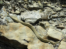
A quick picture of some more neat-o herpetofauna!  This one is a desert horned lizard, from the Valley of Fire State Park in Nevada.


Pretty slick camo, eh?

Monday, December 12, 2011

Privilege, Equality, and Disparity: A Link To A Totally Rad Essay

I just wanted to quickly point out a really excellent essay that does a killer job deconstructing and exploring the (sometimes stealthy) role that "privilege" has in creating disparities between folks.  The essay, titled "Sacrificing Privilege" and hosted at Skepchick, is a clear and well-written exploration of how a "privileged" status, defined on the basis of race, gender, or what-have-you, can serve as the basis of a pervasive and potentially "invisible" culture of bias. 

This is an extremely important message that we in the sciences (and especially the Earth Sciences) NEED to understand if we ever want to get away from the "(White) Boys' Club" that defines so many fields.  As discussed here in a previous post, Geology has a real problem with regards to gender; understanding and working to eliminate the (often hidden) cultural biases that make it hard for women and minorities to find a home in the sciences is the only way that we'll ever get better.  So everyone read the essay linked above!  It's long, but well worth the time!

Tuesday, December 6, 2011

Evaporite Casts in Sandstone

I've been working, as part of the ol' PhD rigamarole, in the Wilkins Peak Member, which is part of the Eocene Green River Formation in southwest Wyoming.  Anyway, this part of the world during the Eocene was characterized by extremely high evaporation coupled with relatively low precipitation, which is a perfect setting for the formation of evaporites!  High evaporation rates drive off water, while leaving behind water soluable ions, resulting over time in highly concentrated brines from which evaporite minerals form. 

In previous posts, I've shown some modern examples of evaporite formation from Death Valley, where evaporites are precipitating on a playa surface, which is a pretty good analogue for parts of the Wilkins Peak.  This previous post actually shows some evaporite mineral casts from the purely lacustrine portion of the Wilkins Peak, probably some sort of Na-rich evaporite.

However, you don't have to be in the lake for evaporites to form!  These pictures below are evaporite mineral casts preserved in sandstones that formed as part of the floodplain/overbank setting of a fluvial system that fed into the lake. 


Here's a closer view, showing the bladed, fairly delicate looking crystalline features of the evaporites, preserved in the sands. 


I reckon these are Nahcolite casts, on account of their elongated crystal habit, but then again I'm no evaporite specialist.  Still, they're kind of nifty!

Friday, December 2, 2011

Ophiomorpha in core

Trace fossils are, as I've said before, pretty rad.  As a sed/strat type, I mostly appreciate them for their utility in paleoenvironmental reconstructions, their ability to help us constrain substrate conditions, and the help they can give us in interrogating rates and processes of sedimentation.  And, of course, there's all sorts of biological and ecological info to be gleaned from the paleoichnological record as well.

Trace fossils are particularly valuable when all you've got is 3 inch-wide cores to work with!  I'm mostly a field guy, but sadly, some strata remain inaccessibly trapped below the surface of the earth, removed from the joyous and perfect cycle of erosion and redeposition that is the true destiny of all rocks everywhere.  When we want to investigate these strata, we're forced to yank a plug of rock out of a well somewhere, and just hope for the best.  It's not ideal, but you gotta work with what you've got...

Anyway, below are a few pictures of some Ophiomorpha traces I found in core from the Paleocene-Eocene Wilcox fluvial/alluvial/deltaic sediments of the Gulf Coast.  Ophiomorpha is such a neat little trace fossil; a little shrimpy bastard digs his way into some shifting sediment, and in order to keep his little dwelling tunnel safe from collapse, he rolls his own shit into little balls, and sticks it into the walls of the burrow.  Ah, The Grandeur of Nature at Work!


In the picture above, we've got a pretty nice cross-section in a massive, medium-grained sandstone.  You can see pretty clearly the nice fecal ball lining surrounding the inner (and, in the animal's lifetime, what would have been hollow) chamber.


Here's a cut along the length of an Ophiomorpha, truncated by an erosion surface and subsequent plow-and-fill sediment, which was itself burrowed into by yet more Ophiomorpha-producin' shrimp.


And, finally, here's an oblique cross-section of another little tube (maybe a bit squashed, as well?).  Trace fossils are handy things to have around, especially when all you've got is core!

Thursday, December 1, 2011

Burgess Fauna Zapruder Film

Here's something to start the day off RIGHT!  A little movie, from the Royal Ontario Museum, showing a catastrophic mud-rich turbidity current sweeping over some poor Burgess Critters!  They've even got the ol' cinematic rumble going on!  Poor little Anomalocaris!

Wednesday, November 30, 2011

Lower Mississippi Valley Geomorph

Google informs me that it is ol' Mark Twain's 176th Birthday today, so a quick post pointing out some pretty nifty Mississippi River research seems appropriate today.  The Army Corps of Engineers has a pretty nice Lower Mississippi Mapping Project webpage that provides access to a classic of the Mississippi River literature: Fisk's 1944 report "Geological Investigation of the Alluvial Valley of the Lower Mississippi River" in pdf form.  It's a classic piece of geo-literature, and was the culmination of a pretty exhaustive survey and mapping project carried out in the Lower Miss. River.  What's EXTRA rad, of course, is the fact that they've also scanned the completely awesome PLATES that went with the report!  Here's a small example below, although the scanned versions are full sized (something like 15 in x 20 in, or so, I reckon):


The plates are color coded for different ages of point bar migration, chute cut-offs, and avulsions, and pretty much succinctly present the whole complicated story of channelbelt evolution in this portion of the lower Mississippi River Valley.  It's a pretty cool resource to have access to, and makes for some pretty posters, as well.

And, while I'm sure everyone enjoys some classic Mississippi River Science on Twain's Birthday, I reckon folks oughta' read SOMETHING by ol' Twain...so here's a link to "The War Prayer", which pretty much says it all, really.  Enjoy!

Wednesday, November 23, 2011

Rocks at Dawn!

Busy busy busy!  Just a quick post with some more pretty pictures from out west...let the glow of dawn light on the fluvial/alluvial Cathedral Bluffs keep you warm on these wintery days!


Interbedded sandstones (of both the channelform and sheety variety) are dominantly white, though up-close inspections reveal a fair amount of lithic fragments, including sed rocks and feldspar rich igneous chunks.  Reddish, laterally extensive silt-rich mudrocks make up the rest of this succession.


Happy Thanksgiving Eve!

Friday, November 11, 2011

Channelform Picture #3241 - Cathedral Bluffs

Cold and dreary November days call for cheery remembrances, so I thought I'd share one with you:  a spiffy little single-story, lateral-accretion dominated channelform from the Eocene of southwest Wyoming, truncating some mud-rich overbank/floodplain deposits.


Man, I have a LOT of pictures of channelforms...

Friday, November 4, 2011

Frickin' Fracking...

Our intense and escalating addiction to sweet, sweet hydrocarbons combined with our collective paranoia about dependency on foreign oil (damn you Canada!) has driven some pretty clever advances in the petroleum geosciences.  Whether in terms of important scientific concepts (like chronostratigraphic approaches to understanding the rock record, or facies model approaches to understanding paleoenvironmental characteristics) or in terms of applied engineering (i.e., all the different ways we now have to acquire and understand subsurface data sets), the need to exploit more and more of the Earth's hydrocarbons have led us into heady intellectual territory. 

Some of the schemes utilized to find and recover hydrocarbons from the subsurface are downright Strangelovian.  While THE goofiest has to be the Wagnerian boondoggle of CO2 sequestration, a close second in terms of seeming craziness is fracking.  Hydrofracking, or simply "fracking" if you're "hip" and "with-it", is the process by which humans enhance the connectivity of an existing oil or gas field.  Briefly, let's say you've got an gas field sitting out in the middle of nowhere.  You know there's hydrocarbons in them there interstitial pores, but your wells aren't producing at the rate or capacity that you had hoped.  What you do then is what every red-blooded human has done since we knapped our first flint; you IMPROVE on nature!  In this case, you pump a slurry of quartz and who-knows-what chemicals under high pressure into the reservoir in question.  The high pressure fluids initiate and build-up a series of new fractures, while the quartz grains prop open the newly anthropogenic fractures, allowing your hydrocarbon fluids to flow more freely.

Fracking has been done for quite a while; commercial use of hydrofracture techniques began in 1949, although people were apparently sending water/nitroglycerine mixtures into wells to do the same thing as early as the 1860s.  A pretty good historiography of hydrofracking techniques can be found here.

Despite this long-term history, Fracking has been in the news recently, on account of Oil Companies expanding interests in shale gas reservoirs.  Shales, of course, are noted for their very poor porosity and permeability; fine-grained muds undergo some pretty impressive compaction in the subsurface, resulting in "tight" rock that really restricts the fluid flow paths.  Since the universe is largely ruled by Irony, however, mudrocks and shales are also often extremely rich in organic material. Organics, when subjected to the right conditions, are what we pump out of the ground in the form of oil and gas.  So, these mud-rich reservoirs are often very high in organic content, but actually REMOVING the fluids-of-interest from those sopping shales can be tricky!  What nature fails to provide, human ingenuity must produce; thus, frack the shit out of some shales, and viola!  You've got a productive field where once was only a tight, uneconomical subsurface lithosome. 

However, some spoilsports don't seem to be willing to embrace the Inevitable March of Progress, and have voiced some concern regarding hydrofracking.  One of the things that seems to have really caught a lot of people's attention is the supposed link between fracking and seismicity.  People are worried that, by producing new fracture networks in the subsurface, hydrofracking might be causing earthquakes.  The idea of human-induced seismicity is one of those sort of Doomsday type things that freak folks out, and there have been a number of reports and anecdotes from folks in and around fracking sites claiming that there has been a noticable increase is earthquakes.  But is there any evidence for such a link?

A company in the UK, Cuadrilla Resources, recently published a report that does, for perhaps the first time, actually seem to support the idea that hydrofracking can be linked to seismic events.  The company was in the Bowland Basin in Lancashire, trying to exploit a shale gas play through hydrofracking.  Their press release can be found here, while the pertinent (and actually fairly interesting) technical report is available as well, titled "Geotechnical Study of Bowland Basin Seismicity". 

Briefly, the company had been monitoring seismic activity during their fracking proceedures, generally through the use of down-hole geophones.  In the past, these had recorded seismic events well below the "0" magnitude threshold that were apparently closely associated with active hydrofracking.  However, there were some larger events, including a 2.3 Magnitude event and a 1.5 Magnitude event that the company believes are highly likely to have been caused by their fracking.  Importantly, neither of these events had any sort of structural effect at the surface, and didn't actually cause any sort of damage.

What is interesting is the fact that the company's study has identified a few contingent geological factors that seem to have been part of the reason for the fracking-induced seismic activity.  These include structurally complicated stratigraphies with locally variable dips as well as pre-existing faults in the succession, which interacted in a sort of "perfect storm" with the hydrofracking to induce slip and result in a series of small earthquakes, including the two "big" ones mentioned above (2.3 and 1.5).  The companies conclusion is that, yes Virginia, fracking DID (most likely) cause these specific earthquakes, but a) they weren't that big and didn't do any damage to structures or the the surface and b) the seismic activity was a result of fracking AND the presence of pre-existing structure.  The company points out that these local conditions imply that fracking induced seismicity can be the result of very specific conditions that have to be met.  Regardless, the report advocates continued monitoring in this and other settings, which would allow us to better understand both the mechanisms and processes that produce fracking seismicity, as well as predict those conditions in other fields in the future.

It's a pretty interesting report, and freely available online, which is nice.  And while it does show that fracking CAN cause seismicity, for the reasons stated above it also shows that this seismicity is not that big a deal and actually probably really rare.  And, to be honest, I never really FELT like there was much danger of fracking being a big deal in terms of causing earthquakes or destroying towns.  Still, it's nice to have some actually science on the subject.

Of course, the REAL worry regarding fracking doesn't have anything to with earthquakes, in my opinion.  That's just the sort of sexy catastrophe-mongering peddled by the popular press, and, at the risk of sounding conspiratorial, just the sort of low-risk/high-publicity kind of thing big Industrial/Business concerns like people worrying about.  As Pynchon wrote in Gravity's Rainbow, "if they can get you asking the wrong questions, they don't have to worry about the answers". 

The Earthquake worry is the wrong question to ask about fracking; what should be eliciting some raised eyebrows is the fact that companies are pumping huge volumes of unknown, proprietary fluids into the ground, with the expressed purpose of making it easier for fluids of ALL kinds to move more easily in the subsurface.  Don't worry about earthquakes destroying central Pennsylvania; worry about ground water contamination!  And not just from the mystery fluids used in fracking.  There's all sorts of unpleasant things in the brines that lurk in the subsurface.  I'd like to see a little more transperancy, and a LOT more science, on the question of what impacts, if any, fracking is actually having on groundwater and the environment. 

And, as pointed out by the Cuadrilla report, it's often a question of local contingencies that matter.  What might be perfectly safe in upstate New York COULD be disastrous in North Dakota, or in Wyoming, or in Romania.  The question of fracking needs some serious study, particularly in light of the complicated natural systems that we geologists know characterize the actual Earth.

Friday, October 28, 2011

Armored Mudballs!

"Quiet water conditions" is the depositional mechanism most often evoked to explain the presence of fine-grained mud in the rock record.  Mud, generally made up of clay minerals, is defined on the Udden-Wentworth grain size scale as particles smaller than ~0.00015 inches, or around 0.003 mm.  That's pretty small, and any amount of turbulence or motion in a water column will keep particles of that size suspended for quite a while.  However, as I've discussed before, there are some hints that a fair portion of mudrock in the stratigraphic record records higher energy conditions; one of the nifty qualities of clay minerals is that they're weakly charged, and can aggregate together into larger "chunks" that behave as hydrodynamically heavier clasts.  Sometimes, the features that would record this sort of aggregate/flocculate behavior of mudclasts is subtle or cryptic, especially once muddy sediment gets compacted and flattened out.  Sometimes, however, the evidence for muddy clasts is obvious!

The picture below is from the Eocene Cathedral Bluffs Member in SW Wyoming/NW Colorado, a pretty thick succession of fluvial/alluvial sediments that form some fairly picturesque vistas in that area.  The channelform sandstones around here are pretty coarse - usually upper Medium at the small end, and sometimes even getting into coarse and very coarse sands (we're pretty near their source area!).  Anyway, in among the fluvial sandstones, are things like this:


That's a gravel-sized clast, maybe 50 mm across or so, made up entirely of clay, and coated on the outside by a nice armor of sandy grains glommed onto the outside!  In a moment of refreshing clarity, the official science word for these things is the surprisingly restrained term "armored mudball".  Nifty, huh?  Here's another shot:


You can see that these muddy clasts are floating in a coarse sandy matrix.  Because these mudballs are so large, they form a nice erosional lag at the base of the channels.


Here's a close up of some of the gravel-sized mudballs:


The shot below shows the muddy interior of these little fellows:


Neat, huh?  Like almost all things in sedimentary geology, mud is a lot more fun once it starts gettin' pushed around by turbulence!