All this nice weather is makin' me hanker some field work! Instead, I wither away, chained to the ol' Word Processor, processin' words. Oh well.
However, a few of us grad students were recently able to slip off for a little local rock hammering. An old railroad cut here in town actually chops right through some pretty awesome Ordovician sandstones, actually providing some pretty okay exposure, for the midwest. These sandstones are stupid-rich with well sorted, well rounded, upper-medium quartz grains; despite this, there's actually some pretty decent sed structures to enjoy, accentuated by weathering.
The picture above shows some fairly nifty cross-stratification. Don't be tricked by the apparent bi-directionality of the cross bedding, though! These are trough cross-stratified sets, formed by the migration of sinuous-crested 3-D dunes. Paleoflow is actually broadly oblique into the picture, with troughs chopping into each other at slightly different angles.
The picture below is a close up of the juxtaposition of two different sets of cross-strata.
If you're not careful, you might interpret these structures as herring-bone cross-stratification, which would imply a tidal sort of paleoenvironment dominated by the bidirectional ebb- and flood-tidal cycles. However, as you can see in the picture above, and with some careful observations on the rocks, the apparently different directions are actually just obliquely cut troughs, with the internal cross-laminae conforming to the immediately local conditions formed by the variable geometries of individual dunes spilling into the erosional scoops forming on their lee-side. Careful paleocurrent measurements from these rocks would actually show a fairly consistent and unidirectional suite of directions, with no evidence of tidal back-and-forth.
To be honest, I've never actually seen ANY convincing "herring-bone" cross-stratified sandstones; EVERY example I've ever been shown in the field turned out to be, upon closer and more careful inspection, the result of obliquely flow-perpendicular exposures of troughs. I'm not saying that herring-bone x-strata don't exist, but just that they're probably grossly over interpreted. A little careful, nose-on-the-rocks geology will rapidly disabuse us of our misapprehensions.
So don't be tricked by crafty sed structures! Do as the geologists in the picture below, and get on those rocks!
Showing posts with label Pretty Picture. Show all posts
Saturday, April 21, 2012
Tuesday, January 10, 2012
Desert Horned Lizard!
A quick picture of some more neat-o herpetofauna! This one is a desert horned lizard, from the Valley of Fire State Park in Nevada.
Pretty slick camo, eh?
Friday, December 2, 2011
Ophiomorpha in core
Trace fossils are, as I've said before, pretty rad. As a sed/strat type, I mostly appreciate them for their utility in paleoenvironmental reconstructions, their ability to help us constrain substrate conditions, and the help they can give us in interrogating rates and processes of sedimentation. And, of course, there's all sorts of biological and ecological info to be gleaned from the paleoichnological record as well.
Trace fossils are particularly valuable when all you've got is 3 inch-wide cores to work with! I'm mostly a field guy, but sadly, some strata remain inaccessibly trapped below the surface of the earth, removed from the joyous and perfect cycle of erosion and redeposition that is the true destiny of all rocks everywhere. When we want to investigate these strata, we're forced to yank a plug of rock out of a well somewhere, and just hope for the best. It's not ideal, but you gotta work with what you've got...
Anyway, below are a few pictures of some Ophiomorpha traces I found in core from the Paleocene-Eocene Wilcox fluvial/alluvial/deltaic sediments of the Gulf Coast. Ophiomorpha is such a neat little trace fossil; a little shrimpy bastard digs his way into some shifting sediment, and in order to keep his little dwelling tunnel safe from collapse, he rolls his own shit into little balls, and sticks it into the walls of the burrow. Ah, The Grandeur of Nature at Work!
Trace fossils are particularly valuable when all you've got is 3 inch-wide cores to work with! I'm mostly a field guy, but sadly, some strata remain inaccessibly trapped below the surface of the earth, removed from the joyous and perfect cycle of erosion and redeposition that is the true destiny of all rocks everywhere. When we want to investigate these strata, we're forced to yank a plug of rock out of a well somewhere, and just hope for the best. It's not ideal, but you gotta work with what you've got...
Anyway, below are a few pictures of some Ophiomorpha traces I found in core from the Paleocene-Eocene Wilcox fluvial/alluvial/deltaic sediments of the Gulf Coast. Ophiomorpha is such a neat little trace fossil; a little shrimpy bastard digs his way into some shifting sediment, and in order to keep his little dwelling tunnel safe from collapse, he rolls his own shit into little balls, and sticks it into the walls of the burrow. Ah, The Grandeur of Nature at Work!
In the picture above, we've got a pretty nice cross-section in a massive, medium-grained sandstone. You can see pretty clearly the nice fecal ball lining surrounding the inner (and, in the animal's lifetime, what would have been hollow) chamber.
Here's a cut along the length of an Ophiomorpha, truncated by an erosion surface and subsequent plow-and-fill sediment, which was itself burrowed into by yet more Ophiomorpha-producin' shrimp.
And, finally, here's an oblique cross-section of another little tube (maybe a bit squashed, as well?). Trace fossils are handy things to have around, especially when all you've got is core!
Wednesday, November 23, 2011
Rocks at Dawn!
Busy busy busy! Just a quick post with some more pretty pictures from out west...let the glow of dawn light on the fluvial/alluvial Cathedral Bluffs keep you warm on these wintery days!
Interbedded sandstones (of both the channelform and sheety variety) are dominantly white, though up-close inspections reveal a fair amount of lithic fragments, including sed rocks and feldspar rich igneous chunks. Reddish, laterally extensive silt-rich mudrocks make up the rest of this succession.
Happy Thanksgiving Eve!
Interbedded sandstones (of both the channelform and sheety variety) are dominantly white, though up-close inspections reveal a fair amount of lithic fragments, including sed rocks and feldspar rich igneous chunks. Reddish, laterally extensive silt-rich mudrocks make up the rest of this succession.
Happy Thanksgiving Eve!
Friday, November 11, 2011
Channelform Picture #3241 - Cathedral Bluffs
Cold and dreary November days call for cheery remembrances, so I thought I'd share one with you: a spiffy little single-story, lateral-accretion dominated channelform from the Eocene of southwest Wyoming, truncating some mud-rich overbank/floodplain deposits.
Man, I have a LOT of pictures of channelforms...
Monday, October 17, 2011
Red Rocks of the Cathedral Bluffs Member
Just a quick post, to get my bloggin' legs back after fall field work/GSA madness! Here's photographic PROOF that not all red rocks in Wyoming are from the triassic; these are from the Eocene strata of the alluvial/fluvial Cathedral Bluffs, in SW Wyoming. Behold!
Take a look at the variably expressed soil forming processes preserved in the stratigraphic record, as well as the subtle channelform! Nifty, huh!?!
Friday, September 2, 2011
Hoodoo Tafoni!
Geology, for all it's complex nomenclature and technical terminology, DOES have some fun words. And, sometimes, you get the chance to combine a couple of fun words together! Behold: HOODOO TAFONI from the Book Cliffs, UT!
Hoodoos are pinnacles of rock caused by caps of resistant lithology that shield underlying sediments from erosion. They tend to look a little rude, and are also (ridiculously) called "fairy chimneys" and "earth pyramids". Tafoni has already been discussed, both at this blog and others. These are erosional features in sandstones that look a little like a bunch of little pits, caused probably by differential weathering.
Hoodoo Tafoni would also make a pretty good band name, when you think about it.
Hoodoos are pinnacles of rock caused by caps of resistant lithology that shield underlying sediments from erosion. They tend to look a little rude, and are also (ridiculously) called "fairy chimneys" and "earth pyramids". Tafoni has already been discussed, both at this blog and others. These are erosional features in sandstones that look a little like a bunch of little pits, caused probably by differential weathering.
Hoodoo Tafoni would also make a pretty good band name, when you think about it.
Friday, August 12, 2011
Boar's Tusk!
Following up on yesterday's post and Callan's rad red desert gigapan, I thought I'd share a couple more shots, this time of the Boar's Tusk and a little of the Killpecker dune field. If you ever find yourself along Highway 191, you'll be driving right alongside a pretty phenomenal little bit of the high desert that, in addition to some slick geology, is also full of nice scenery. I'd just caution, however, that if you DO decide to drive on the BLM roads, make sure you've got a vehicle with good clearance and four-wheel drive...it can get a little dicey!
Anyway, a prominent feature in the area is the Boar's Tusk. Just like the more famous Devil's Tower, this pinnacle is a Pleistocene-aged volcanic neck that marks the formerly active volcanic fields of the area. It's about 400 feet tall, and is a favorite nest-building site for hawks in the area.

There's a steep little path up to the saddle, but like all volcanic terrain, a fall here can really hurt, so do be careful.

Here's a view, from the saddle, looking south towards White Mountain (the low plateau to the right).

And here's a view looking north, into Killpecker dunes, which is one of the largest active dune fields in the region. Although it's pretty from a distance, the dunes are infested with 4-wheelers and ATVs and the associated jackassery that goes along with it.

Nothin' TOO spectacular, rock wise, but there's some all-right volcanic stuff to look at, IF that's your thing...
The Boar's Tusk has also lent it's name to a beer available at the Bittercreek Brewpub in Rock Springs, WY.
Anyway, a prominent feature in the area is the Boar's Tusk. Just like the more famous Devil's Tower, this pinnacle is a Pleistocene-aged volcanic neck that marks the formerly active volcanic fields of the area. It's about 400 feet tall, and is a favorite nest-building site for hawks in the area.
There's a steep little path up to the saddle, but like all volcanic terrain, a fall here can really hurt, so do be careful.
Here's a view, from the saddle, looking south towards White Mountain (the low plateau to the right).
And here's a view looking north, into Killpecker dunes, which is one of the largest active dune fields in the region. Although it's pretty from a distance, the dunes are infested with 4-wheelers and ATVs and the associated jackassery that goes along with it.
Nothin' TOO spectacular, rock wise, but there's some all-right volcanic stuff to look at, IF that's your thing...
The Boar's Tusk has also lent it's name to a beer available at the Bittercreek Brewpub in Rock Springs, WY.
Thursday, August 11, 2011
White Mountain Petroglyphs
Callan recently put up a pretty slick gigapan of some rocks near and dear to my heart. He's got an awesome shot of the Green River Formation exposed on the flank of White Mountain, which I've talked about before (I work in the fluvial portions of the Wilkins Peak Member of the ol' Green River Fm, which is the most clastic phase of the Green River).
If you ever find yourself in the area, you could do worse than just heading north up Highway 191, and taking some time to explore the BLM roads in the area. There are actually some pretty cool petroglyphs to be found in the fluvial sandstones of the Wasatch Formation (Paleocene/earliest Eocene) that underlies the Green River Fm in the Bridger Sub-basin. I visited a BLM-run spot on the flank of White Mountain that showcases some of the best ones to be found in the area, and I thought I'd share some photos:

The picture below is a little washed out...but if you embiggen it by clicking, you'll see an elk:


Pretty neat! The Sweetwater County tourism board has some info available on the BLM administered site, including driving directions, here.
If you ever find yourself in the area, you could do worse than just heading north up Highway 191, and taking some time to explore the BLM roads in the area. There are actually some pretty cool petroglyphs to be found in the fluvial sandstones of the Wasatch Formation (Paleocene/earliest Eocene) that underlies the Green River Fm in the Bridger Sub-basin. I visited a BLM-run spot on the flank of White Mountain that showcases some of the best ones to be found in the area, and I thought I'd share some photos:
The picture below is a close-up of the buffalo(?) in the above shot:
The picture below is a little washed out...but if you embiggen it by clicking, you'll see an elk:
Friday, August 5, 2011
This thing still on?
Whew! A little over a YEAR since the last post....kinda lame, but you know how it is. Busy busy busy, and all that wearisome nonsense. Anyway, maybe we can get this piece of shit blog back on the road, alright?
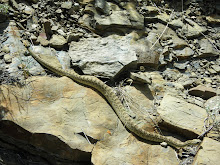
At the very least, let's give that poor Cnemidophorus tigris septentrionalis a little break, huh?
Here's a pretty picture of two rainbows, out Wyoming way, that may warm your hearts...

I promise the next post won't take a year to make an appearance!
At the very least, let's give that poor Cnemidophorus tigris septentrionalis a little break, huh?
Here's a pretty picture of two rainbows, out Wyoming way, that may warm your hearts...
I promise the next post won't take a year to make an appearance!
Wednesday, June 30, 2010
Wednesday, June 16, 2010
The Little Grand Canyon of the San Rafael Swell
I recently spent around 2 weeks bopping around the west, and in particular looking at the completely rad geology to be seen in Utah, Our Nation's Prettiest State. Anyway, one of the places I camped at was a BLM campground south of Price, UT, called "The Wedge". The Wedge sits right in the heart of the San Rafael Swell. Anyway, at this spot, the San Rafael river has sliced clean through the uplift, exposing a a fair bit of the stratigraphy; the Permian Kaibab Limestone at the base, up through the Chinle/Moenkopi red beds and windblown Wingate Sandstone (Triassic), and finally the aeolian Navajo (Jurassic). It's a pretty spot, and one I'd highly recommend for camping and hiking, if you find yourself in the area. Below are some pictures, taken right from the campground, of this amazing area.
The late spring had apparently seen a fair bit of snow, so it's awfully green out that a way right now!
Monday, May 3, 2010
Modern Mangroves
Just a brief picture-y related post, as I try and rise above the clinging busy-ness of the end-o'-the-semester. I was lucky enough to head down to South Florida over the spring break (in late March), and in addition to eating all sorts of delicious shell fish and exotic fruits (sapote! sapodilla!) I also had the chance to see some pretty rad mangroves swamps!
Mangroves, of course, are the utterly kick-ass salinity-tolerating plants that form impressively dense coastal swamps along tropical shorelines. Because they live in environments that are, traditionally, so hostile to plants, these awesome trees have evolved some pretty slick adaptations. They can excrete excess salt from their roots and leaves, which is pretty awesome, and can similarly limit water loss during low-tide exposures. And, from a sedimentological view point, they are also completely amazing sediment baffles, effective at dissipating incoming wave energy and trapping any entrained sediment. Neat-o!
Anyway, the picture below is from Florida bay, and just shows some isolated red mangroves growing out in the shallows. When we came back and mucked around in the mud after low tide, the WHOLE area was just covered in horseshoe crab traces going everywhere (no pictures, sadly...). In the background on the right, you can JUST make out the distopian hellscape that is Miami.

This next picture is from the Everglades, and shows some more Red Mangroves growing along the edge of the brackish water Coot Bay, and were taken as we canoed around the backwaters. Notice the oysters encrusting the mangrove limbs! Neat!

Here's another oyster and mangrove shot!

And, finally, here's some mangrove pneumatophores exposed along the canal access to Coots Bay.

Pretty amazing plants!
Sunday, January 31, 2010
Mudball clasts
Over the holiday break, I had the chance to visit Providence Canyon, GA, sometimes called the "Grand Canyon of Georgia", since it's the biggest hole (other than Zell Miller) in all of the state. Anyway, the canyon is a big ol' erosional feature caused by extremely poor land management in the 1800's; basically, someone irrigation ditches got a "little out of hand", and resulted in a 200 foot canyon that exposes Cretaceous shoreface sandstones. The picture below is a view out into the canyon from the rim.


Anyway, while tromping around in the canyons proper, we came across some features that made me think of my Mud as Sand post from last year. In that post, I discussed some work by Wright and Marriott, a Sedimentary Geology article from 2007 entitled "The dangers of taking mud for granted: lessons from lower Old Red Sandstone dryland river systems of South Wales." In this paper, Wright and Marriott (2007) point out that mud, when glommed together into larger mudballs, can behave hydrodynamically as sand grains. Thus, some of the mud that we so glibly ID as "fine-grained suspension fallout" is actually the result of traction current sedimentation in turbulent flows, and probably has some sort of bed structure, cross-stratification, etc. in it.
In addition to all the sand in Providence Canyon, there is a lot of muddy sediment exposed as well. We had been hiking around after a series of pretty big rainstorms, and I was busy sticking my nose into every rill, cut, and stream channel I came across. Mostly, they conformed to expectations, like the nice-little bit of braid-plain self-similarity evidenced in this erosional feature below:
I also came across some rather larger clasts, hanging out as lags in the bases of the little creeks that drain the main arms of the canyon. Like so:
HOWEVER, upon closer inspection, I found that these clasts were, in fact, entirely made of clay aggregates! In the picture below, you'll appreciate how sticky they are:
So just think about that next time you come across a muddy lens in some channelform sandstone body, eh? Mayhaps it's not finer grains settling out during waining flow, but something even cooler: mud aggregates behaving as sand!
Labels:
Fluvial Facies,
Mudrock,
Pretty Picture,
Sed Structure Sunday
Sunday, December 6, 2009
The Return of Sunday Sed Structures!
A substantial hiatus between "Sunday Sed Structures", perhaps, but seeing as how I'm a fan of the ol' Sed/Strat side of things, I reckon it's perfectly acceptably for me to engage in hiatuses of all sorts (as well as terrible pun-based stratigraphy humor). Below is a picture from the Holiest of Holies, The Book Cliffs!
A pretty big piece of float, perhaps, but it illustrates the elusive and complex 3-Dimensional nature of bedforms rather nicely, I think. On the right-hand face of the boulder, you can see the more traditional trough cross-stratification, oriented roughly parallel to flow. On the left-hand face, you can see the troughs themselves; this view is roughly perpendicular to flow, and preserves the scoop-like trough that is the cross-stratification's namesake. Just goes to show you that when dealing with trough cross-stratification and paleocurrent orientation, you gotta be careful, and TRY to find some nice 3-D (or, more likely, the good ol' 2-and-a-half-D) exposure.
Sunday, September 27, 2009
Hawk vs Duck
Tuesday, August 11, 2009
Might as well post a picture, while I'm at it...
Since I'm in town, using that there internets to do my patented "Last Minute Abstract Submittal" to GSA, I thought I'd slap up a picture of some nifty soft-sed deformation. Here you go (in the words of the Prophet, "Click it, and it shall be Bigger"):

This picture is from some Cretaceous deltaic stuff exposed on the Rock Springs Arch, a little east of that shining beacon of metropolitanism, Rock Springs Wyoming. A picture of this very outcrop is in the "Roadside Geology of Wyoming", making it famous, I guess. That same book probably also tells you the name of the unit it's in, which escapes me now (I THINK it's Mesaverde Group, but I can't get any finer scale than that).
Anyway, you can see the nice folding going on in these slippery, mudrock and sandstone prodelta interbeds. If you look REALLY close, near the core of the fold, there's a little red stripe of something...that's my rockhammer for scale. The metal post on the right is a Speed Limit Sign, which is maybe 6 or so feet tall? So it's a good sizes feature. If you're every heading out on I-80, this outcrop is right on the westward-side of the interstate, a few miles before you get to Rock Springs proper. Take a look!
This picture is from some Cretaceous deltaic stuff exposed on the Rock Springs Arch, a little east of that shining beacon of metropolitanism, Rock Springs Wyoming. A picture of this very outcrop is in the "Roadside Geology of Wyoming", making it famous, I guess. That same book probably also tells you the name of the unit it's in, which escapes me now (I THINK it's Mesaverde Group, but I can't get any finer scale than that).
Anyway, you can see the nice folding going on in these slippery, mudrock and sandstone prodelta interbeds. If you look REALLY close, near the core of the fold, there's a little red stripe of something...that's my rockhammer for scale. The metal post on the right is a Speed Limit Sign, which is maybe 6 or so feet tall? So it's a good sizes feature. If you're every heading out on I-80, this outcrop is right on the westward-side of the interstate, a few miles before you get to Rock Springs proper. Take a look!
Thursday, July 30, 2009
Field Pictures
Gotta get a post in before July vanishes! I've been out fieldin' it up in Wyoming since mid-June or so, which has resulted in a SHOCKING lack of updates; luckily for me, the geoblogosphere gets pretty quiet come the summertime, which I choose to interpret as evidence for Milankovitch cyclicity as an allogenic forcer on the internet. THERE IS NO OTHER VIABLE INTERPRETATION.
Anyway, thought I'd just post up a quick few pictures of the pretty scenery out West; maybe at the end of the field season I'll put some sed/strat specific pictures up, but these ones below are more of your "Gosh-golly-geewilikers! Purty!" type of pictures.
This first picture (below) shows the Green River Formation (Eocene); the yellowish-tan stuff at the base of the cliff is the Tipton, while the white-colored interval (shot through with some pretty rad brown sandstone) are the Wilkins Peak Member (that's my baby). The river in the background is the Green, making the Flaming Gorge Recreation Area behind a dam.

This next picture is Exhibit #34591 in the continuing series "Rocks That Have Been Shaped Into Rude And Amusing Shapes"; its a pinnacle made up of the volcaniclastic-rich deltas of the Sand Butte Bed, which marks the fillin' in of Eocene Lake Gosiute. On the topo maps of the area, this feature is referred to as "South Chimney Butte"; the Locals have another name for it.

This picture is of the Green River Formation, expressed on the EASTERN side of the Rock Springs Arch, sort of near(ish) to the town of Wamsutter. The red-n-green funtime strata are alluvial and fluvial strata of the Cathedral Bluffs Member (equivalent to the Wilkins Peak on the West flank of the Arch), while the lakey lookin' white tannish/whitish stuff in the Laney Member of the Green River Fm.

Finally, here's a picture of a Hawk that was yelling at me for a good couple of hours. I must have been taking paleocurrents in it's living room, since there was a huge nest not to far away from where this picture was taken.

All right, back to the Field!
Anyway, thought I'd just post up a quick few pictures of the pretty scenery out West; maybe at the end of the field season I'll put some sed/strat specific pictures up, but these ones below are more of your "Gosh-golly-geewilikers! Purty!" type of pictures.
This first picture (below) shows the Green River Formation (Eocene); the yellowish-tan stuff at the base of the cliff is the Tipton, while the white-colored interval (shot through with some pretty rad brown sandstone) are the Wilkins Peak Member (that's my baby). The river in the background is the Green, making the Flaming Gorge Recreation Area behind a dam.
This next picture is Exhibit #34591 in the continuing series "Rocks That Have Been Shaped Into Rude And Amusing Shapes"; its a pinnacle made up of the volcaniclastic-rich deltas of the Sand Butte Bed, which marks the fillin' in of Eocene Lake Gosiute. On the topo maps of the area, this feature is referred to as "South Chimney Butte"; the Locals have another name for it.
This picture is of the Green River Formation, expressed on the EASTERN side of the Rock Springs Arch, sort of near(ish) to the town of Wamsutter. The red-n-green funtime strata are alluvial and fluvial strata of the Cathedral Bluffs Member (equivalent to the Wilkins Peak on the West flank of the Arch), while the lakey lookin' white tannish/whitish stuff in the Laney Member of the Green River Fm.
Finally, here's a picture of a Hawk that was yelling at me for a good couple of hours. I must have been taking paleocurrents in it's living room, since there was a huge nest not to far away from where this picture was taken.
All right, back to the Field!
Subscribe to:
Posts (Atom)