THE DYNAMIC EARTH: A BLOG ABOUT GEOLOGY AND THE EARTH SCIENCES

Thursday, August 7, 2008

Green River Formation From The Air

If any geologists out there have thousands upon thousands of dollars, lots of free time, and a daring streak, I think I have a hobby suggestion for you: build and fly your own airplane.

While out in the wilds of Wyoming, I had the opportunity to go up in a homemade RV-8 airplane (crafted and piloted by my advisor) and see my field area from above. From a purely geological viewpoint, it was actually an amazing chance to view some mega-scale architecture in real time. It really gives you a chance to see the basin at a scale that you rarely get, including the opportunity to actually see lateral changes across miles and miles of outcrop.

Of course, from a purely "havin-fun" viewpoint, I can only say HOLY CATS IT IS AWESOME I GOT TO FLY THE PLANE AND THEN WE PULLED 2-G'S WHEN WE DID A 60 DEGREE BANK AND YOU COULD SEE SO FAR AND I GOT TO WEAR A HEADSET AND IT WAS SO COOL CAN I GO AGAIN MOM PLEASE!?! So there's that, too.

Anyway, I brought up one of them there digital cameras along, so I though I might share some pictures with you guys.

The picture below is of the bustling burg of Rock Springs, going about it's pathetic, earthbound existence, while I soar, godlike, above the peons who call it home. In the background, you can see White Mountain, with the Wilkins Peak Member of the Green River Fm making up the white band. Nifty!


This next picture, below, shows pretty much all of the Green River Fm exposed down in this part of the Greater Green River Basin. The tan-yellowish stuff that caps these ridges is the Sand Butte Member of the Green River Fm, and represents the infilling of Eocene Lake Gosiute with volcaniclastic detritus sourced from up North somewheres (Absaroka or Challice Volcanics). The white band is more of the Wilkins Peak, and the very lowermost stuff is the Tipton Member.


This next picture shows more of the same, but from a steeper angle.


The picture below shows one of these enormous channelforms that I am particularly interested in, lemme-tell you. Its a pretty big body, too, on the ground; a good couple of km, easy.


I was camping a little off-picture in this area. It is quite pretty from the ground, too.


I think I'm at the limit of my google-mandated picture postin, so mayhaps I'll put some more up later!

Tuesday, July 22, 2008

The one-armed man!

Green River, Wyoming, has a fairly notable geo-historical claim to fame. It was the launching point for one of the most grueling, dangerous, and all-around craziest projects ever: The Exploration of the Colorado River and its Canyons, undertaken by none other than J.W. Powell. Ol’ Powell and nine other guys, all with limited boating experience, set out in four boats from Green River, and boated through uncharted rapids, climbed mountains, and were nearly drowned and starved many, many, many times (seriously, like once a week, it seemed…). And all in the name of SCIENCE (well, that, and expanding American influence into the southwest…).

But what is important to remember, is that Maj. Powell had only ONE DAMN ARM to do all this with.


The picture above is of an almost ridiculously heroic statue of ol’ Powell in the town of Green River, right outside Sweetwater County Museum, which is actually a surprisingly nice little museum with some nifty stuff on display. Anyway, Powell lost his arm at the battle of Shiloh, in the Civil War. For those unfamiliar with the history of the battle of Shiloh, let me sum it up: it kind of sucked to be at Shiloh.

Anyway, despite getting his arm blasted off, ol Powell went on to a successful career as a geologist, the high point of his career (and the general stamp that earned him the title of “Chief Badass”) being the Colorado expedition. Despite only having one arm, Powell would ramble up and down mountains, climb up cliffs, and carry out successful geological and mapping surveys. He also had numerous brushes with death, and still would write in his diary about what a great time he was having.

I’m sure we’ve all known folks who like to act like they’re Dr. Hardcore in the field, and heck, some of us might even think we’re the damn Delta Force when we’re out there; but, in all honesty, can’t no one hold a candle to Wes Powell. He was one bad motha-

Watch your mouth!

Just bloggin’ about John Wesley Powell…

We can dig it!

Friday, July 4, 2008

The Great Southern California ShakeOut

The best way to celebrate the Fourth is to celebrate the kind of citizen driven public programs that really benefit people. To this end, I give you The Great Southern California ShakeOut!

I recently (~10 minutes ago) found out about The Great Southern California ShakeOut, which is a fantastic initiative designed to educate Californians about earthquake preparedness. Set to run the week of Nov. 12-16, the ShakeOut is a series of events that includes the world’s largest earthquake drill, a conference on earthquake policy, and state-wide emergency response drills. The USGS is participating in the effort, and the whole thing has a slick website with many links, as well as a Blog designed to keep the updates rolling.

In addition to the laudable goal of helping people who live in hazard zones deal with the inevitable clash of geology and civilization (which, at last score, was something like Geology – 109, Civilization – 0), efforts like this could also be used to help folks learn about the science behind these natural systems. As seen in the recent flooding in the mid-west, fundamental misunderstandings regarding Earth system processes still permeate the public mindset (i.e., multiple “500-year floods” within a short period); the first step to adequately preparing for disasters is to understand the processes at work, whether they be fault motions, drainage basin processes, or hurricane dynamics.

To this end, the USGS and the ShakeOut initiative has put up a couple of circulars, including a 300+ page Open File Report detailing the science behind the simulation scenario (a 7.8 magnitude earthquake), and provides some nice, simplified science outreach material. Hopefully, in addition to taking the preparations to heart, people will also start to appreciate how much of an impact fundamental science can have on their lives. Good job, ShakeOut!

Saturday, June 28, 2008

Eocene Gooney Birds

Out here in Wyoming, the alluvial and lacustrine deposits preserve some pretty nifty trace fossils. While boppin' around the fluvial strata in the basin (which is my focus), I ran across some pretty slick tracks, shown in the picture below.


These bird tracks have been attributed what was most-likely an extremely goofy looking Eocene bird, Presbyornis. I know, it might seem to be a little harsh to just summarily judge some poor extinct critter as silly lookin', but come on! Here's a life reconstruction of the goofy guy, (picture seized from here):


Presbyornis looks like a flamingo, and probably lived like a flamingo, but was actually a member of the Order Anseriformes, making it more closely related to a duck. Paleo-folks reckon it dabbled in the shallow, saline lakes in the western U.S., eating up brine shrimp and probably getting giggled at by all the other birds in the area.

Tuesday, June 24, 2008

Wyoming vistas

The weather out here in Wyoming is great; western summer's just can't be beat, in my opinion. Big blue sky, lots of sun and heat, and the famous Wyoming breezes (and, occasionally, gales). We've been lucky down in this corner of SW Wyoming, since most of the grimmer weather has been up in the North (Jackson Hole and the Teton area) and East (Gilette). Earlier in the field season (~2 weeks ago, now), we got hit with some serious wind and some snow, but, as they say, C'est le Wyoming.

The picture below was taken from the top of an outcrop, and about 15 seconds after taking the picture, a huge snow storm blew up, and dropping visability to about 20 feet or so. Since I was on top of a mountain, I kind of had to wait it out.


Its not all blizzards, of course! The picture below was from another mountain on another day...the wind was still gusty as hell, but at least I had a good view.


Say what you will about the west...it makes for some pretty pictures...


And some good geology!

Monday, June 16, 2008

Snakes on a planar-tabular cross-bedded sandstone

Ugh. Sorry about the awful title. Having been away from the internet for a week now, I'm giddy with the flow of electrons, and am therefore not responsible for my blogging actions.

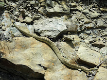
One of the fun things about being in the field is the constant brushes with critters that always happens. Nothin' like wrasslin' a bear to get the heart pumping! Anyway, I ran into a little rattler, hanging out on a cow path, and snapped a quick a picture. The little guy was just trying to get warm, and this big dumb geologist almost ran right over him.


The picture below is of a snake I ran into back in Montana, hanging out on a rippled sandstone. He was not to pleased to see me, and quickly hustled off to a hole in the ground to get away from the glare of the camera.


Any other neat pictures of critters in the field out there?

Monday, June 9, 2008

Field Schedule

Hello from the Happiest Place on Earth (Wyoming). It's gonna get kinda lite around these parts of the blogosphere, because I've finally slipped the surly bonds of coursework and have begun a summer of field work. Ahhhh....breathe it in.
Anyway, I'll periodically have internet-access when I'm hitting up the old laundro-mats, so I'll probably be making some posts here and there. But until then, everybody enjoy their summer, hit some rocks with a hammer, and remember that life, by and large, is good.

Tuesday, June 3, 2008

Soil-forming processes and soil taxonomy

In 1964, Supreme Court Justice Potter Stewart, making a ruling about indecent or obscene materials, said something along the lines of pornography being hard to define, but you know it when you see it. Soils are a lot like pornography: you know em when you see em, but everyone has a hard time agreeing on a definition.

Soil taxonomy is intimately tied to the genetic processes that drive soil formation. These processes are:

- Parent Material: what the soil has weathered from plays an important role, both in physical properties of grains (i.e., grain size and sorting) as well as the chemical properties of the subsequent soil.
- Biotic Processes: plant and animal activity can have a strong influence on soils. This can include moving sediment and aerating the soil through the actions of burrowing and tunneling animals (which can act to disrupt soil horizons), or aiding the transmission or removal of material through the action of plant community root networks.
- Topography: the local configuration of the earth-surface has a strong influence on soil formation, controlling the amount of solar energy hitting the surface, influencing drainage patterns for groundwater, and affecting the types of plants and animals that can live there.
- Climate: the long term temperature and precipitation trends in a region strongly influence soil formation, both directly through temperature and precip, as well as indirectly by controlling plant and animal communities.
- Time: soil formation requires time, and the development of soil horizons and soil zones is related to how much time the various soil forming processes have had to act on the soil material.

These soil-forming processes were first described by Hans Jenny, considered to be the father of modern pedology, in a 1941 book entitled The Factors of Soil Formation (the link takes you to a pdf of the 1991 reprint of the classic). Soil science, like much of the natural sciences, was hit pretty hard with the old reductionism, and that influence is evident in Jenny’s book, where he posits that quantification of these processes is the key to understanding soils. We won’t get into it too much here, but obviously, it’s a bit more complicated than all that.

What should be obvious from the list of soil forming processes above is their interrelatedness. Only Time, in its abstract sense, is truly a dependant variable here (and even then, one could make the argument that the time available for exposure and soil formation is related to the rate and magnitude of sedimentation events, which can be controlled by local topography, climate, and parent material). Anyway, the point is that because of these complexly interacting variables, defining discrete soil taxa is a very difficult thing. Often, arbitrary cut-offs between some attribute of a soil (such as base saturation) are employed to divide soil orders.

And because of this difficulty, there are numerous soil classification schemes employed by different people across the world. The Food and Agriculture Organization of the UN has its own soil classification scheme, differentiated from one another by the relative importance of those processes listed above. Below is the world soil map, taken from this site, according to the FAO:


The USDA system, employed in America, has its own classification system, and includes the following 12 soil orders:

- Alfisols: aluminum and iron enriched soils, often associated with hardwood forests
- Andisols: soils formed in volcanic material (ash)
- Aridisols: soils with low productivity, and associated with arid climates
- Entisols: incipient soils with little or no horizonation
- Gelisols: soils associated with permafrost
- Histosols: organic-rich soils
- Inceptisols: weakly developed soils
- Mollisols: organic-rich soils associated with grasslands
- Oxisols: soils contained highly weathered materials
- Spodisols: soils with a highly weathered zone, often associated with pine forests
- Ultisols: heavily-weathered soils, specifically with no calcareous matieral and low base saturation
- Vertisols: soils with large amounts of expanding clay minerals

Broadly, the orders represent the influences of the different soil forming factors of Jenny; operational definitions of these, however, often rely on detailed mineralogical and chemical analyses, association with known biotic communities and climates, and delicate fabric and textural interpretations from soil pits. As such, extending this classification into the rock record can be tricky in many cases (such as interpreting soil slickensides in paleovertisols), and impossible in some (such as being able to interpret moisture content in a paleosol from the Triassic).

Next time, we’ll dive into the PALEOSOL classification schemes!

Monday, June 2, 2008

Adventures in Nomenclature: Soil

After a brief jaunt into the paleopedogenically-affected Chugwater Fm, we return now to the issue of soils and their stratigraphic occurrence. Before diving into the fun stuff (like correlation strategies, biotic and climatic inferences from paleosols, or paleogeomorphology), we have to lay down a terminological brickwork. First and foremost: WHAT is a soil, anyway?

“Soil” is actually a tough nomenclatural nut to crack. The Soil Science Glossary (published by the Soil Science Society of America) presents the following definition:

“soil - (i) The unconsolidated mineral or organic material on the immediate surface of the earth that serves as a natural medium for the growth of land plants. (ii) The unconsolidated mineral or organic matter on the surface of the earth that has been subjected to and shows effects of genetic and environmental factors of: climate (including water and temperature effects), and macro- and microorganisms, conditioned by relief, acting on parent material over a period of time. A product-soil differs from the material from which it is derived in many physical, chemical, biological, and morphological properties and characteristics.”

Importantly, this definition rests heavily on the role of soil in cultivation and agriculture (a future post will deal with the implications of accepting or ignoring the necessity of land plant-activity on soil occurrences). Part (ii) offers a definition that implies a genetic connotation; however, this part also reads like a simple definition of weathered material. Is all clastic sediment a soil, then?

A different, though similar, definition is taken from the bible of Soils Sciences, the 2nd edition of Soil Taxonomy, written by the USDA’s Soil Survey Staff (and available in all its 800+ page glory here):

“Soil - Soil is a natural body comprised of solids (minerals and organic matter), liquid, and gases that occurs on the land surface, occupies space, and is characterized by one or both of the following: horizons, or layers, that are distinguishable from the initial material as a result of additions, losses, transfers, and transformations of energy and matter or the ability to support rooted plants in a natural environment.
The upper limit of soil is the boundary between soil and air, shallow water, live plants, or plant materials that have not begun to decompose. Areas are not considered to have soil if the surface is permanently covered by water too deep (typically more than 2.5 meters) for the growth of rooted plants.
The lower boundary that separates soil from the nonsoil underneath is most difficult to define. Soil consists of horizons near the earth's surface that, in contrast to the underlying parent material, have been altered by the interactions of climate, relief, and living organisms over time. Commonly, soil grades at its lower boundary to hard rock or to earthy materials virtually devoid of animals, roots, or other marks of biological activity. For purposes of classification, the lower boundary of soil is arbitrarily set at 200 cm.”

Aside from wordiness, these two definitions have a lot common, though there are important differences. The Soil Taxonomy definition singles out the presence of recognizable horizons within the soil as key. These horizons are the result of the differentiation of the parent material into separate components, driven by subtle differences in processes during soil formation. Unstated but implicit within this definition is the fact that soils occur in situ; they are not transported, but rather represent a geomorphic surface of exposure that reflects a period of non-deposition that allows for the parent material to undergo soil forming processes.

In the more geologically-centered literature, Retallack (2001) defines a soil more generally as “material forming the surface of a planet or similar body and altered in place from its parent material by physical, chemical and biological processes.”

The nature of how these processes proceed, interact, and change plays an important role in soil taxonomy, which will be the focus of a future post, as well. In the mean time, I’ll leave you with a picture of how these horizons manifest themselves in the field. Behold:


The picture above is of a soil pit from ‘round these parts, showing the interpretations of different horizons, based on LOTS of different parameters, including pH, root density, bioturbation evidence, and clay content. How these horizons are organized plays an important role BOTH in tagging a soil with a technical name as well as in interpreted the soil-forming processes, which are what we'll be talking about next time.

Just for book-keeping, I think the future posts will proceed roughly in the following order:

- Soil Forming Processes
- Soil Taxonomy
- Paleosol Nomenclature
- Paleosols and Stratigraphy
- Paleosols and Bioturbation
- Soils on Other Planets!

CITED

Retallack, G.J., 2001, Soils of the Past: An Introduction to Paleopedology, 2nd Ed, Oxford, Blackwell, 404 p.

Soil Science Survey, 1999, Soil Taxonomy, USDA, 871 p.

Thursday, May 29, 2008

Chugwater

Two posts in one-day! I must be jacked up on coffee something fierce!

Anyway, I was going through my photos from the recent industry-sponsored field trip to Wyoming, and I realized I had taken some panoramas that needed some stitching, stat. So I put a pot of coffee on, started up Photoshop, and got to work (as an aside, using a computer is, for me, an experience I would best describe as "harrowing"). I persevered, however, and present the fruits of my labor, below.


Anyway, this panorama is of the Triassic Chugwater Formation, exposed at the Alcova Reservoir in Wyoming (which is a completely awesome place, I might add). I expect Jeannette, who was also on the field trip, might start posting some stuff too, so I'll wait and see what she puts up before going into to much detail on the trip (I know that both of us got some pretty slick pictures, too).

Anyway, the Chugwater Fm is largely composed of silts and fine sands, and has been seriously messed up by a fair bit of gypsum. Sed structures are very rare, sadly. On the plus side, it is really really really red. Separating the lower Chugwater from the upper Chugwater is the Alcova Ls, representing a phase of shallow-water, carbonate-rich lake sedimentation that contrasts with the heavily oxidized, pedogenically-altered alluvial and fluival intervals of the rest of the formation. Unfortunately, we didn't get to spend much time looking at the unit on the trip, as we were focused on hitting the underlying Pennsylvanian Tensleep Sandstone.

Anyway, if you find yourself with some time in Wyoming, I would heartily suggest checking out the Alcova Reservoir. Rent yourself a boat at the marina and go for a paddle; there are a lot of really nifty exposures in the area.